


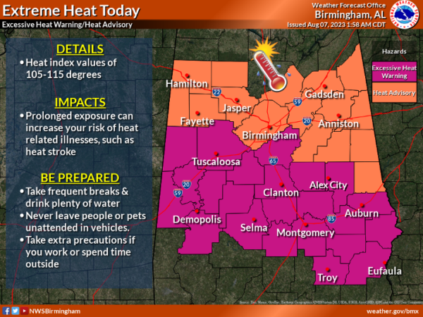
DANGEROUS HEAT LEVELS AGAIN: An Excessive Heat Warning is in effect for the southern half of Central Alabama today, while a Heat Advisory is in effect for the northern half. Heat index values will be in the 105°-115° range today; take it easy out there today. Big HEAT mean Big STORMS, and another afternoon of strong to severe storms will occur across Alabama.
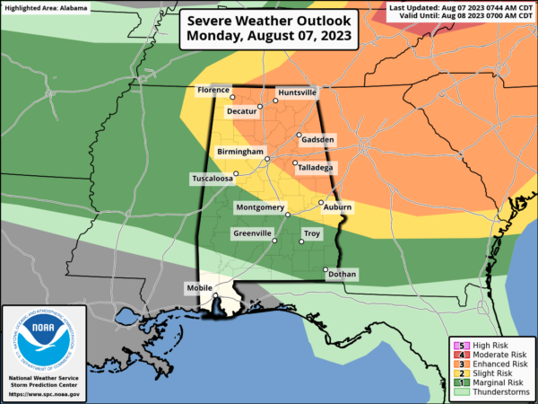
SEVERE STORMS: The SPC has defined an “enhanced risk” (level 3/5) of severe thunderstorms for much of North/Central Alabama, from Florence to Jasper to Birmingham to Alexander City. A “slight risk” (level 2/5) extends down to Reform, Montgomery, and Eufaula, and a “marginal risk” (level 1/5) covers much of the rest of South Alabama.
Like recent days, the main issue is damaging straight line winds that can bring down thousands of trees and cause serious power outage issues. The core risk of severe thunderstorms will come from roughly 1PM-9PM. We encourage you to pay attention to severe thunderstorm warnings since a number of them will likely be needed.
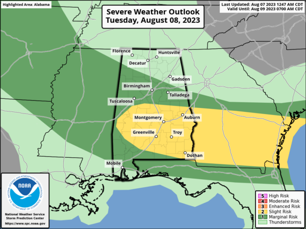
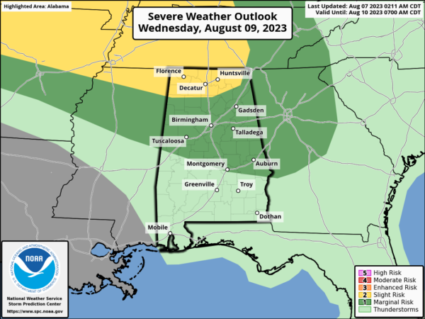
MORE SEVERE STORMS AHEAD: It won’t be as hot in the coming days, but we are still going to be dealing with more strong to severe storms. The SPC has defined level 1/2 risks for parts of the state both days. Most, but not all of the showers and storms will come in the noon to midnight window. The chance of any one spot seeing rain both days is 55-65%.
THURSDAY THROUGH THE WEEKEND: For now it looks like some typical August weather for the state with a mix of sun and clouds daily along with “scattered, mostly afternoon and evening showers and thunderstorms”. Highs will be right at seasonal averages, in the low 90s. And this will continue through the weekend and into next week. Partly sunny days with an afternoon thunderstorm possible in spots; highs generally in the low 90s
IN THE TROPICS: All is quiet and no tropical cyclone development is expected through the upcoming weekend.
BEACH FORECAST CENTER: Get the latest weather and rip current forecasts for the beaches from Fort Morgan to Panama City on our Beach Forecast Center page. There, you can select the forecast of the region that you are interested in visiting.
WORLD TEMPERATURE EXTREMES: Over the last 24 hours, the highest observation outside the U.S. was 119.8F at Basrah-Hussen, Iraq. The lowest observation was -115.6F Vostok, Antarctica.
CONTIGUOUS TEMPERATURE EXTREMES: Over the last 24 hours, the highest observation was 117F at Death Valley, CA. The lowest observation was 34F at Brookvale, CO.



