


Happy Father’s Day to all the dads out there!
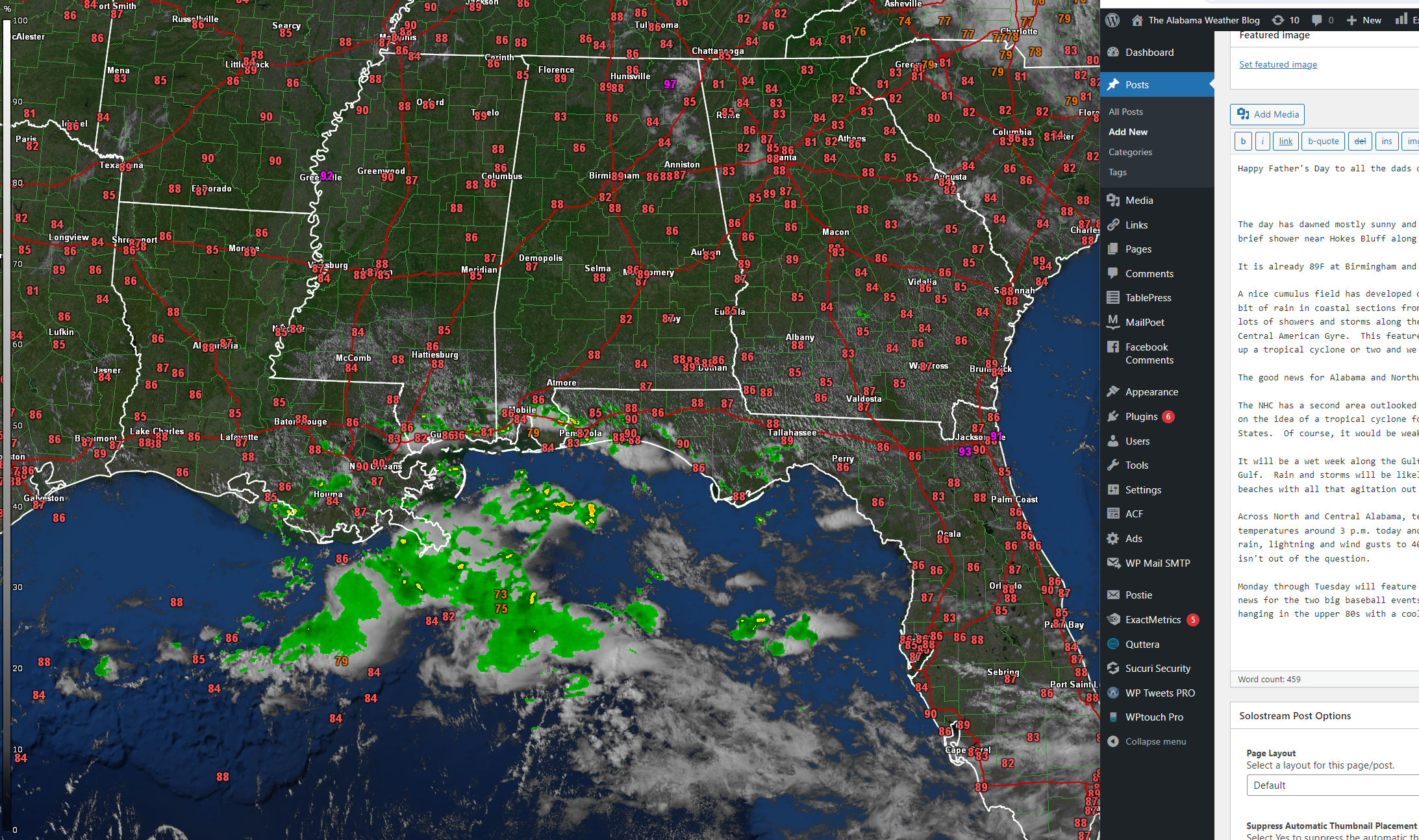
The day has dawned mostly sunny and hot across Alabama. There are some patchy low clouds in Northeast Alabama that even may have produced a brief shower near Hokes Bluff along the Etowah Cherokee county line just after 7 a.m.
It is already 89F at Birmingham and Decatur.
A nice cumulus field has developed over South Alabama and adjacent portions of the Panhandle as well as southern Mississippi. There is quite a bit of rain in coastal sections from Southeast Louisiana then along I-10 through Mississippi, Alabama, to near Pensacola in Florida. There are lots of showers and storms along the coast near Fort Walton, Destin, and Panama City. These are thanks to inverted troughs rotating around the Central American Gyre. This feature can bring disturbed weather to the southwestern Gulf and that will be the case this week. It can also spin up a tropical cyclone or two and we will be watching that.
The good news for Alabama and Northwest Florida is that these systems tends to stay south in Texas or Mexico.
The NHC has a second area outlooked around the Bahamas for some tropical mischief later in the week. The GFS and even the Euro has been bullish on the idea of a tropical cyclone forming by late in the week near the Bahamas that would move into northern Florida and perhaps across the Gulf States. Of course, it would be weak, but could bring a narrow path of heavy rain with it.
It will be a wet week along the Gulf Coast will all that tropical moisture funneling up on the right side of whatever manages to form in the Gulf. Rain and storms will be likely all week, especial from the Alabama coast westward. There will also be a high rip current risk along the beaches with all that agitation out over the ocean.
Across North and Central Alabama, temperatures will spar into the mid and upper 90s this afternoon. This will allow us to reach our convective temperatures around 3 p.m. today and scattered showers and storms will form. If any decent multicellular structures form you will see very heavy rain, lightning and wind gusts to 40 mph. Brief flooding could occur. They are not expected to be severe, although a rogue warning or two isn’t out of the question.
Monday through Tuesday will feature scattered storms in the afternoons and evenings, but Tuesday through Saturday looks mostly dry. That’s great news for the two big baseball events at Rickwood Field Tuesday and Thursday evenings. It will be slightly cooler Tuesday and Wednesday with highs hanging in the upper 80s with a cooler easterly flow. Lows 90s should prevail Monday and after Wednesday into the weekend.



