


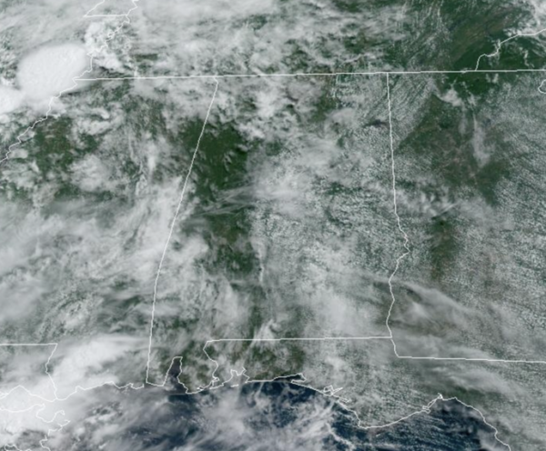
NOT AS HOT: The weather this week will be fairly routine for mid-June in Alabama, each day will feature a mix of sun and clouds. A few afternoon showers and storms are possible today, but easterly flow takes over in the state tomorrow and the forecast will be mainly dry through Thursday. Afternoon highs will generally be in the low 90s this week.
BIRMINGHAM ALMANAC: For June 17th, the average high for Birmingham is 89° and the average low is 69°. The record high is 100° set in 1918, while the record low is 52° set in 1974. We average 0.16” of precipitation on this date, and the record value is 2.06” set in 1939.
ACROSS THE USA: The first significant heat wave this season will impact much of the Midwest, Great Lakes, Mid-Atlantic and Northeast this week. Record high temperatures and rapid onset drought is possible. In the northern Plains and Upper Midwest, strong to severe thunderstorms with excessive rainfall are possible today. Dry, gusty winds will bring critical fire weather to the Four Corners and central California.
FRIDAY AND THE WEEKEND: Heat levels rise again with highs potentially in the upper 90s by Saturday and Sunday. A tropical wave will weaken as it approaches from the east, but it could bring enough moisture for some increase in the number of random, scattered, mostly afternoon and evening showers and storms this weekend, especially across eastern portions of the state.
IN THE TROPICS: Two areas the National Hurricane Center is monitoring, one of which should become Alberto sooner than later.
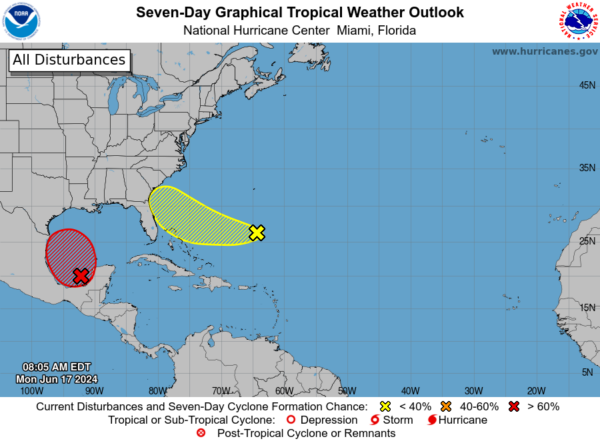
1. Satellite imagery and surface observations indicate that a broad area of low pressure is forming over the Bay of Campeche. Environmental conditions appear conducive for additional gradual development, and a tropical depression or tropical storm is likely to form by midweek while it moves slowly westward or west-northwestward toward the western Gulf coast.
Regardless of development, several days of heavy rainfall are expected across portions of southern Mexico and Central America, and these rains are likely to cause life-threatening flooding and flash flooding. Locally heavy rainfall is also expected to spread over portions of the northwestern coast of the Gulf of Mexico by the middle of the week. In addition, gale warnings have been issued for portions of the Gulf of Mexico, and more information on those warnings is available in High Seas Forecasts issued by the National Weather Service. Interests along the western and northwestern Gulf coasts should monitor the progress of this system. An Air Force Reserve Hurricane Hunter aircraft is scheduled to investigate the system later today. Formation chance…high…70 percent.
2. Southwestern Atlantic Ocean: An area of cloudiness and thunderstorms located several hundred miles east of the Bahamas is associated with a surface trough and an upper-level area of low pressure. Environmental conditions could be conducive for some development of this system during the next few days while it moves westward or west-northwestward. The system is forecast to approach the coast of the southeast United States on Thursday or Friday. Formation chance through 7 days…low…30 percent.
BEACH FORECAST CENTER: Get the latest weather and rip current forecasts for the beaches from Fort Morgan to Panama City on our Beach Forecast Center page. There, you can select the forecast of the region that you are interested in visiting.
WORLD TEMPERATURE EXTREMES: Over the last 24 hours, the highest observation outside the U.S. was 122.0F at Amarah, Iraq. The lowest observation was -97.2F at Vostok, Antarctica.
CONTIGUOUS TEMPERATURE EXTREMES: Over the last 24 hours, the highest observation was 115F at Rio Grande Village, TX. The lowest observation was 22F at Kirk, OR.



