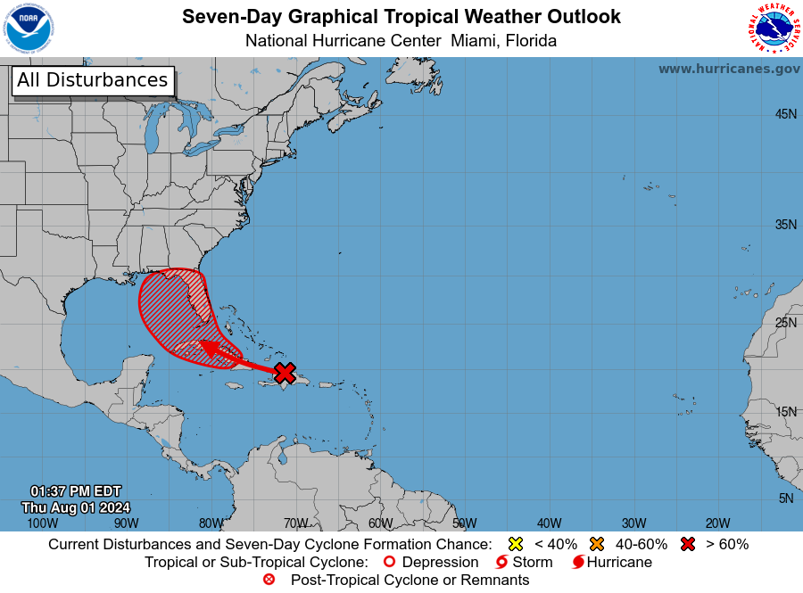
The National Hurricane Center continues to monitor closely a well-defined tropical wave (Invest97L) that is bringing showers and thunderstorms across portions of the Caribbean. There is now a 70% chance for tropical development as this wave moves west-northwest. A tropical depression could form this weekend or early next week. Based on the latest model trends, the development could be over the eastern Gulf of Mexico or near the Florida Peninsula. The water temperatures are plenty warm for this to occur. A lot of uncertainty on the direction and speed amongst the model runs especially beyond the weekend. We will keep you updated on the progress of this system and any potential impacts for the state of Alabama. Now is a good time for all coastal interests to review your hurricane preparedness plans.

Published on: August 1, 2024 at 1:34 PM
Related Articles
October 17, 2026 at 7:05 AM
Breezy Saturday, Fall Weekend in Store
A strong, dry cold front pushed through Alabama yesterday, and much cooler drier air been filtering into the state throughout the night. This weekend will feature highs and lows quite seasonable for this time of year with elevated winds today. As we head into next week, an upper-level ridge from the west will cause temperatures to increase each day. Alabama will remain rain-free through the 7 day period. Continue reading →
READ MORE
October 16, 2026 at 9:37 PM
Restoring Service after Hurricane Isaias
Alabama Power restored service to about 90% of customers within 24 hours after Hurricane Isaias, mobilizing thousands of workers and advanced storm-planning tools to recover from widespread damage across south Alabama. Continue reading →
READ MORE
