


It’s Labor Day weekend, the unofficial end of summer, and Monday also marks the start of meteorological fall. North Alabama has already been getting a taste of it, with cooler mornings and drier air filtering southward behind a weak cool front. The week ahead will keep that early-fall feel in the air at times, though some unsettled weather is still on the docket.
SATURDAY RECAP
A cold front slipped slowly south across North Alabama, and drier air surged in from Tennessee, scouring out clouds and keeping conditions tranquil under strong subsidence and northwesterly flow aloft. Patchy fog largely failed to form thanks to a light northerly breeze and dry advection, so the day turned sunny and comfortably crisp for late August. Morning lows dipped into the mid–upper 50s (lower 60s farther south), then ample sunshine still pushed highs into the 85–90° range. Skies stayed mostly clear into the night with another good setup for radiational cooling.
Saturday turned stormy across South Alabama as a slow-sagging boundary and PWATs near 2″ fueled numerous to widespread thunderstorms from Dauphin Island to Dothan. Slow movers dumped localized heavy rain with poor-drainage flooding in typical trouble spots, while inland saw spottier coverage. Despite the clouds and rain, highs held in the 80s with a noticeably muggier feel than earlier in the week, then settled into the mid–upper 60s overnight. With the boundary slipping a bit farther south, coverage should ease a notch today.
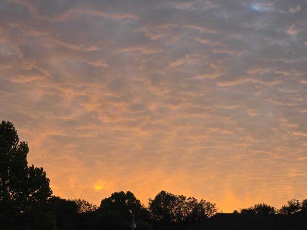
FROM THE SKYWATCHERS: Vic Bell in Black Creek reported 57, Jeff Lee in Carbon Hill reported 56, Brent Wyatt in Morris reported 60 this morning, Chris Cheatwood in Anniston had 64, Robyn Choiniere in Orange Beach had 73 breezy degrees. This lovely photo on the sunrise in New Market came from Sandra Kirkwood!
A LATE SUMMER RESPITE
The last weekend of August continues to deliver a taste of early fall across Alabama. Cool mornings, comfortable humidity, and highs in the 80s make this stretch stand out compared to a typical late-summer pattern. But as we move through Sunday and into next week, moisture begins to return, leading to an increase in clouds, scattered showers, and eventually a more unsettled stretch heading into the new month.
DRY START FOR MOST
High pressure over the Great Lakes and Northeast extends southward into Alabama, keeping most of the state dry to start Sunday. Dewpoints remain in the 50s and 60s, and skies are partly cloudy. Highs reach the low to mid 80s in the valleys, with cooler readings over higher terrain. Any patchy fog early will be confined to river valleys and lakes.
SHIFTING WINDS AND GULF MOISTURE RETURN
By Sunday afternoon, surface winds turn more easterly and eventually southeast as a wedge of high pressure builds down the Appalachians. This begins to draw in moisture from the Gulf. A weak convergence axis may bring a few isolated showers into southeast Alabama late in the day and evening, with moisture spreading northwest overnight.
SHOWERS SNEAK INTO NORTHEAST ALABAMA
A strong high over the Great Lakes will nose into the Northeast on Sunday, reinforcing a cold-air damming wedge down the Appalachians. As surface winds gradually swing around to the southeast, low-level convergence may set up across northeast Alabama. This subtle but important feature could squeeze out a few isolated showers Sunday afternoon and evening, with the convergence axis drifting northwest overnight. It’s not a widespread rain setup, but it’s a neat reminder of how big-picture patterns like cold-air damming can nudge moisture back into our region and spark some localized activity.
INCREASING SHOWERS AND STORMS EARLY WEEK
Monday and Tuesday look wetter statewide. A boundary draped across the region, combined with weak disturbances aloft, will lead to more widespread showers and storms. While instability is not extreme, CAPE values around 1000 J/kg and PWATs climbing to 1.3–1.5 inches will support thunderstorms with lightning and locally heavy rainfall. Rain chances increase further on Tuesday as additional shortwaves pass through.
MIDWEEK FRONTAL CHALLENGE
By Wednesday and Thursday, a stronger system digs into the Great Lakes, pushing a cold front toward the Tennessee Valley. The southern edge of this system may brush into northern Alabama Thursday with another round of storms. Depending on how far south the forcing extends, more storms will be back in the forecast with Alabama mainly seeing some heavy rain and gusty winds.
REFRESHING FINISH
Behind the front, Friday looks cooler and drier once again, with dewpoints falling into the 40s and 50s. Highs stay in the 80s, lows dip back into the 60s, and Alabama enjoys another stretch of fall-like air heading into next weekend.
NATIONWIDE SNAPSHOT
Cool, fall-like air settles across the Eastern U.S. through the holiday weekend behind a recent front, with highs mostly 60s–70s and crisp 40s–50s at night (some 30s in interior Northeast). Meanwhile, a soggy, stormy corridor from the Gulf Coast to the Plains and southern Rockies brings rounds of drenching thunderstorms and localized flash flooding, with the greatest concern across parts of the Plains and southern Rockies. Out West, a rebuilding ridge dries things out and turns up the heat—90s to near 100 in lower deserts and parts of the Northwest. Looking ahead to next week, a reinforcing trough deepens over the central/eastern U.S., driving a strong cold front and well-below-normal temperatures across the Plains, Midwest, and Great Lakes/Ohio Valley (record-cold daytime highs possible, even a touch of frost near Lake Superior), while monsoonal moisture sneaks back into the Southwest/Great Basin for scattered storms under otherwise hot ridge-dominated conditions.
FROM SCORCHING DESERT TO MOUNTAIN CHILL: NATION’S HIGHS AND LOWS ON SATURDAY
The nation’s highest temperature on Saturday was 113 degrees at Death Valley, California, a place that continues to live up to its reputation as the hottest spot in the country. On the opposite extreme, the nation’s lowest reading was a chilly 28 degrees reported 14 miles west-southwest of Mackay, Idaho, showing the sharp contrast in late August weather across the United States.
DANCING WITH THE STATS — LOUISIANA EDITION
On Friday, Louisiana pulled off a weather two-step. In Baton Rouge, the day topped out at just 81°, tying the record for the coldest daily maximum previously reached in 2005, 2015, and 2017, with local records dating to 1892. Farther northwest, Shreveport soaked through a daily rainfall record as 4.62 inches fell, surpassing the old mark of 3.67 inches set in 1911 and standing out in a climate record that runs back to 1874. Quick takeaway: a fall-flavored cool day in Baton Rouge while Shreveport soaked up a century-old rainfall mark.
SEVERE WEATHER OUTLOOK
No organized severe thunderstorms are expected today across the nation. A couple of stronger storms may pop up across the southern Plains, but the setup doesn’t support any widespread or organized severe threat.
FLOODING RISK
Flash flooding remains a concern today in two regions: across eastern Nebraska where saturated soils from Saturday’s storms set the stage for renewed heavy rainfall, and from southern New Mexico into west and central Texas where slow-moving storms may repeat over the same areas. Both regions are under a Slight Risk for excessive rainfall, with additional Marginal Risk areas stretching across the southern tier and portions of the Plains.
BEACH FORECAST
It will be a generally safe but unsettled day along the beautiful beaches of Alabama and northwest Florida. Water temperatures remain comfortably warm in the mid 80s, but spotty showers and thunderstorms are possible, especially around the Panhandle and Big Bend. Rip current risk stays mostly low on the Alabama coast and western Florida Panhandle, but moderate risks are present farther east near Apalachicola and St. Joe Beach. On Labor Day, stronger northeast winds will raise the rip current risk and surf to 2–3 feet at times, so extra caution is advised if you plan to head into the water.
TROPICS
Only one disturbance being tracked, a tropical wave in the far eastern Atlantic. Even it will turn north and northeast away from land as it develops this week. Nothing else on the horizon for the next 7-10 days. Amazingly quiet as we head into the peak of hurricane season.
WEATHERBRAINS
WeatherBrains will air Tuesday night, September 2, at 7 PM CDT, live on YouTube at youtube.com/weatherbrains. This week’s guest is Barb Boustead, author of Wilder Weather: What Laura Ingalls Wilder Teaches Us About the Weather, Climate, and Protecting What We Cherish. She will share how the vivid weather described in the Little House books resonates with today’s climate and weather challenges. The show is also available at weatherbrains.com and on all major podcast platforms.
ON THIS DATE IN 1979:
A tragic lightning strike in Blount County turned a summer football practice into heartbreak. During the afternoon, a thunderstorm swept through Cleveland and a high school coach, Michael Dixon, 27, was struck and killed by lightning on the practice field. Six players nearby sustained minor injuries from the same bolt. The storm was moderate in intensity, but the strike underscored the deadly danger of lightning and left the community grieving on the eve of a new school year.



