ALABAMA YESTERDAY
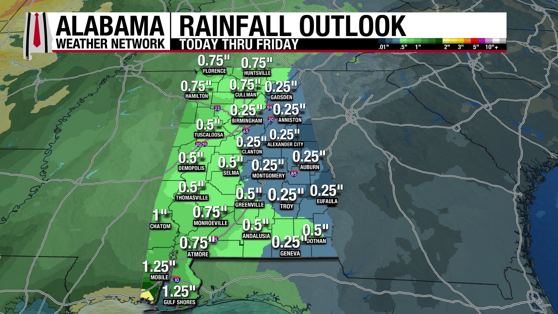
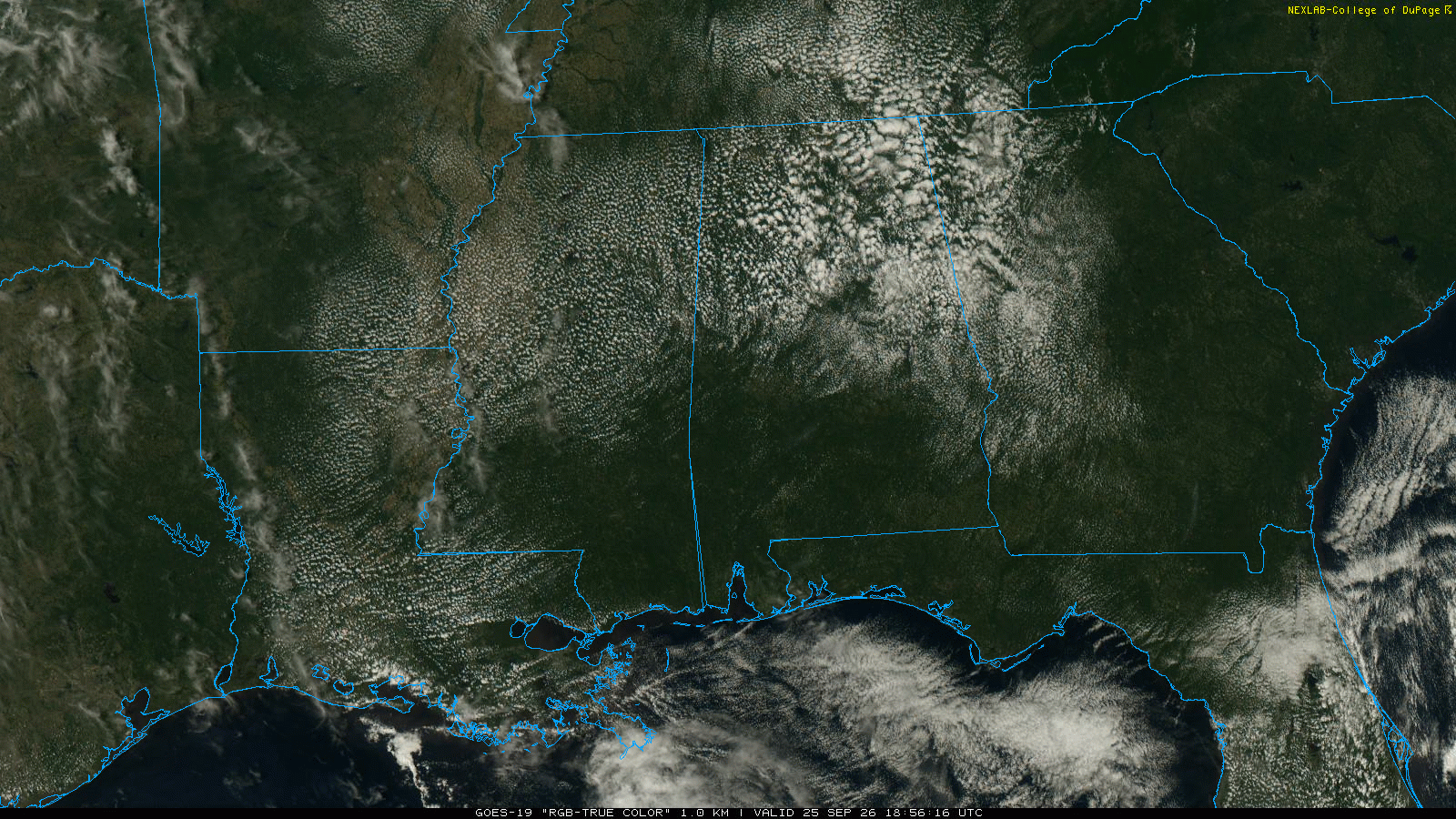
Widely scattered showers and thunderstorms dotted the state again, but most spots stayed dry. A few areas picked up healthy totals — Spann Skywatcher Joey Amberson measured 0.89″ in Birmingham, while Mobile officially logged 0.36″.
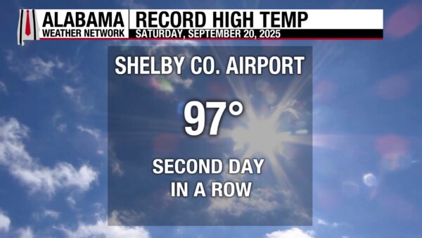
The rain we saw in Mobile didn’t help with the heat, as the high still hit 94°. Birmingham and Dothan each climbed to 97°, while Huntsville topped out at 93°. For the second day in a row the Shelby County Airport saw 97° for a high, breaking the record once again! It topped 96° set in 2010.
ALABAMA THIS MORNING
As of 7 AM, temperatures across Alabama were running in the 60s to lower 70s with muggy air in place. In the north, Muscle Shoals reported 68° under clear skies, Courtland was at 63°, and Huntsville checked in at 68°. Guntersville was one of the warmer spots at 72°.
Central Alabama was starting off mostly in the upper 60s to low 70s. Birmingham reported 73°, Shelby County Airport was at 67°, and Pell City and Talladega were around 68°. Tuscaloosa came in at 68°, with Demopolis slightly cooler at 64°.
South Alabama readings were generally near 70°. Montgomery and Evergreen each showed 66°, Mobile was at 69°, and Fairhope checked in at 70°. Along the Florida line, Pensacola was holding near 70°.
It’s a warm, humid morning across the state, setting the stage for another hot afternoon with scattered storms developing later today.
ALABAMA FORECAST
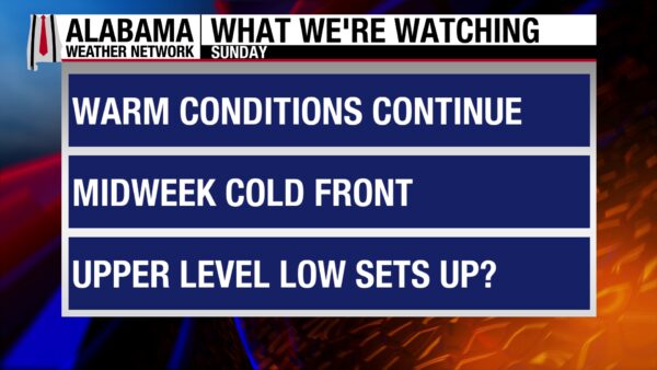
Another hot, muggy day is ahead to close out summer, with scattered storms possible across the state. A midweek front will finally bring more widespread rain before cooler, drier air arrives by the weekend.
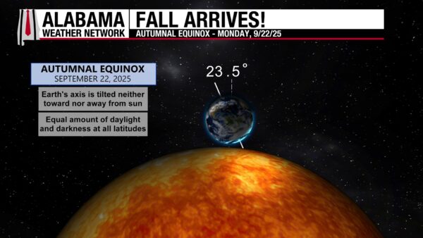
LAST DAY OF SUMMER RUNS HOT
Summer ends on a familiar note across Alabama, with highs in the upper 80s in the Tennessee Valley and low to mid-90s central and south. Scattered thunderstorms develop through the afternoon, bringing downpours, lightning, and gusty winds before easing after sunset.
MUGGY NIGHTS, DAILY STORMS CONTINUE
Overnight lows remain warm, in the upper 60s to near 70. Monday — the first official day of fall — brings more of the same, with sunshine early and scattered storms in the afternoon. Tuesday follows suit with spotty coverage, highs in the lower 90s, and another muggy night to follow.
MIDWEEK FRONT BOOSTS RAIN CHANCES
A stronger system arrives Wednesday into Thursday, raising rain and storm coverage across the state. Storms may become more organized by Wednesday evening, especially north of I-20, with periods of heavy rain possible through Thursday. Highs ease into the 80s with muggy lows in the 60s.
COOLER, DRIER TO END THE WEEK
By Friday and the weekend, humidity drops and temperatures settle into the low to mid-80s for highs. Nights turn more comfortable, with lows in the 50s in north Alabama and 60s central and south. It’s a noticeable break from the heat, though not a true fall feel just yet.
NATIONAL
HEAVY RAIN AND FLOOD RISK IN THE MIDWEST/PLAINS
Rounds of thunderstorms continue from Missouri and Kansas into Arkansas and Oklahoma today, with a Slight Risk (level 2 of 4) for flash flooding. By Monday, the threat spreads into the Ohio Valley and Mid-South, while additional flooding risk builds again Tuesday over the Ozarks.
MONSOON SHOWERS RETURN TO THE SOUTHWEST
Moisture feeding into Arizona and New Mexico will bring scattered storms today and Monday, especially along the Colorado River Valley and into central Arizona. Isolated flash flooding is possible in spots with heavier downpours.
WARM END TO SUMMER ACROSS THE CENTRAL AND EASTERN U.S.
Temperatures climb into the upper 80s and 90s from Texas through the Southeast, with mid-80s reaching into the Ohio Valley. The Northeast stays cooler today before warming early in the week, while the West holds near or slightly below seasonal averages.
PACIFIC FRONT BRINGS RAIN TO THE NORTHWEST
A cold front sliding into the Pacific Northwest keeps showers around today, spreading east into the northern Rockies by Monday. Cooler conditions persist before a warming trend develops midweek.
NATIONAL HIGH AND LOW TEMPERATURE
The hottest spot Saturday was 105° at 4 miles south of Tolleson, AZ, while the coldest dipped to 24° at 14 miles west-southwest of Mackay, ID.
TROPICS
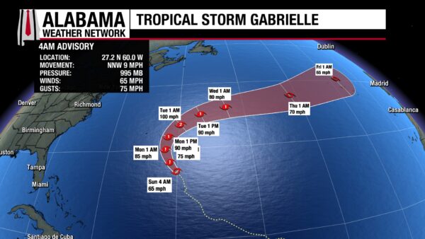
GABRIELLE NEARING HURRICANE STRENGTH
Tropical Storm Gabrielle, located about 455 miles southeast of Bermuda early this morning, is expected to become a hurricane later today. The storm is moving north-northwest at 9 mph and should pass east of Bermuda on Monday before turning northeastward. Swells from Gabrielle will reach the U.S. East Coast from North Carolina northward, as well as Atlantic Canada, beginning later today, creating dangerous surf and rip currents.
CENTRAL ATLANTIC WAVE SHOWS MODEST POTENTIAL
A broad tropical wave in the central Atlantic, located well west-southwest of the Cabo Verde Islands, is producing disorganized showers and storms. While development is not expected in the short term, conditions should gradually improve later this week. A tropical depression could form as the system tracks west-northwest to northwest across the central Atlantic. The National Hurricane Center gives the wave a near 0 percent chance of formation in the next two days, but a 40 percent chance within seven days.
BEACH
LOW RIP CURRENT RISK HOLDS TODAY
It’s a good beach day along the Alabama and northwest Florida coast, with mostly sunny skies and highs in the upper 80s. Surf stays around 1 foot, water temperatures are in the mid-80s, and the UV Index is high. Winds turn onshore this afternoon, light at 5 mph. A low rip current risk continues, but dangerous currents can still form near piers and jetties, so check local flags and patrol guidance.
EYES ON MIDWEEK CHANGES
The low rip current risk should last into Tuesday, but a shift to stronger onshore flow Wednesday into Thursday could bring an upgrade to moderate risk.
WEATHER HISTORY
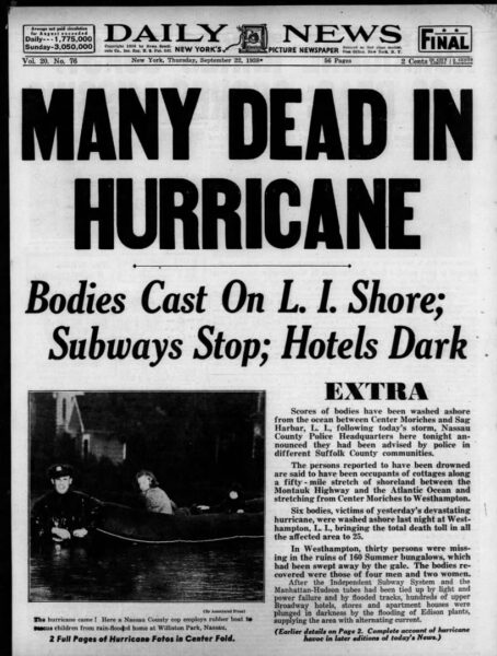
The Great New England Hurricane struck on September 21, 1938, catching forecasters and residents off guard. It made landfall on Long Island as a Category 3 before crossing into Connecticut later that afternoon. A storm surge up to 17 feet inundated Rhode Island, flooding downtown Providence, while gusts reached 186 mph at Blue Hill Observatory and wave
WEATHERBRAINS
EPISODE 1027: SEVERE WEATHER PROGRAM LEAD
This week’s WeatherBrains features Randy Bowers, the National Weather Service Severe Weather Program Lead. His role covers strategic planning, tactical execution, and ensuring consistency across all severe weather services provided by the NWS.
Bowers brings deep experience from forecast operations in Indianapolis, Norman, Amarillo, and Goodland, and his passions include mesoscale meteorology and radar. He’s also been active in several testbeds, helping advance new techniques and technology aimed at improving forecast and warning operations nationwide
You can watch Live on our Youtube channel, Monday, September 22 at 7pm CT! Playback available the next day on our website and your favorite podcast platform.