


Daily Weather Briefing
Sunday, December 14, 2025
ALABAMA YESTERDAY
Yesterday featured quiet and pleasant weather across Alabama, with highs ranging from the upper 40s to low 50s in the north and mid to upper 50s across central and southern areas, with a few low 60s near the Gulf Coast. High temperatures included 48° in Huntsville, 55° in Birmingham, and 61° in Dothan.
ALABAMA THIS MORNING
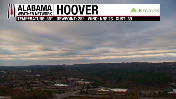
A powerful Arctic air mass is pouring into Alabama, bringing the coldest temperatures of the season along with biting winds. The next several days will feature dangerous cold, followed by a gradual warming trend and a return to rain chances later in the week. This wintry look was captured from our Regions Skycam in Hoover this morning.
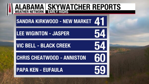
High temperatures on Sunday are occurring during the pre-dawn hours across much of North and Central Alabama. Here were some of the early highs reported by our Skywatchers before temperatures began falling rapidly. Sandra was down to 27 degrees at 5:57 a.m., and Chris dropped to 42 degrees at 4:55 a.m.
Join the team. Learn how to become a Spann Skywatcher at [https://www.spannskywatchers.com/](https://www.spannskywatchers.com/).
TODAY – BITTER COLD AND STRONG WINDS
A sharp cold front has pushed through the state, allowing Arctic air to flood southward. Skies will clear from north to south, but temperatures will struggle to rise, with highs only in the upper 20s to low 30s north, 30s central, and falling through the 40s and 50s early in south Alabama. Gusty north winds of 15 to 30 mph will make it feel much colder, with wind chills in the teens and 20s statewide.
Cold Weather Advisories are in effect across Alabama today and tonight due to dangerously low wind chills and temperatures. Residents should take precautions to protect people, pets, plants, and pipes.
TONIGHT – DANGEROUS FREEZE STATEWIDE
Clear skies and diminishing winds will allow temperatures to drop rapidly after sunset. Lows will fall into the lower to mid teens across north Alabama, upper teens to low 20s in central areas, and low to mid 20s along the Gulf Coast. Even with lighter winds late, wind chills will dip into the single digits and teens, making this one of the coldest nights in several years for many locations.
MONDAY – COLD BUT SUNNY
Despite abundant sunshine, the Arctic air mass remains firmly in place. Highs will only reach the upper 30s to low 40s north, mid to upper 40s central, and near 50 degrees south. Winds will be lighter than Sunday, but the air will still feel sharply cold, especially during the morning hours when wind chills remain in the teens and 20s.
TUESDAY, WEDNESDAY AND THURSDAY – SLOW WARMING, RAIN RETURNS
A hard freeze is again possible early Tuesday morning, with lows in the 20s statewide before a warming trend begins. Tuesday afternoon highs rebound into the upper 40s and 50s north and 50s to near 60 south. By Wednesday and Thursday, milder air returns with highs climbing into the 60s and even low 70s near the Gulf Coast. Clouds increase midweek, and scattered showers become more likely Wednesday night into Thursday, with no widespread severe weather expected at this time.
FRIDAY AND SATURDAY – SEASONABLE WITH A COOL FRONT
A cold front moves through late Thursday night or Friday, bringing drier air and slightly cooler temperatures. Highs settle back into the 50s and 60s with cool mornings in the 30s and 40s. Another weather system may approach late next weekend, but for now the pattern looks quieter with temperatures closer to seasonal norms.
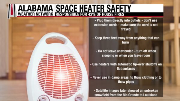
WINTER SPACE HEATER FIRE SAFETY
With this dangerous cold snap, space heaters can help keep you warm, but they also increase the risk of house fires if not used properly. Keep heaters at least three feet away from anything that can burn, including curtains, furniture, and bedding, and never leave them running unattended or while you sleep. Plug heaters directly into the wall, avoid extension cords, and make sure they have an automatic shutoff feature in case they tip over. Taking a few extra precautions now can help everyone stay warm and prevent house fires during this stretch of bitterly cold weather.
A RECORD IN ONE OF MY FAVORITE PLACES
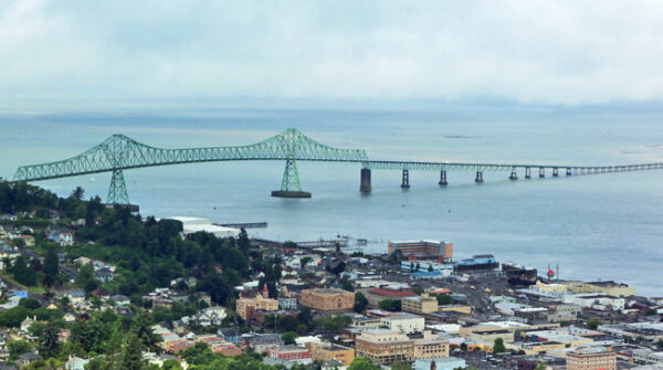
One of my favorite places in the Pacific Northwest, Astoria, Oregon, quietly added a new line to the record books yesterday. The thermometer reached 59 degrees, tying a record that had stood since 1929. Perched at the mouth of the Columbia River, Astoria is a historic coastal town known for its Victorian homes, working waterfront, and dramatic views where the river meets the Pacific. It’s a place that usually feels cool, misty, and timeless in December, which makes a record-tying warm day there all the more striking.
– Bill Murray
ARCTIC COLD GRIPS THE EAST
Much of the Eastern U.S. is dealing with a sharp blast of Arctic air today, especially across the Midwest, Ohio Valley, and Northeast. Highs will struggle in the single digits and teens, with record-cold daytime temperatures possible. Freeze warnings extend as far south as southern Georgia and northern Florida tonight.
LAKE EFFECT SNOW CONTINUES
Cold northwest winds behind the departing system are fueling lake-effect snow downwind of the Great Lakes. Portions of the Lower Great Lakes could see 6 to 12 inches of snow through Monday evening, with localized higher totals. Snowfall will be most persistent east of Lakes Erie and Ontario.
HEAVY RAIN RETURNS TO THE PACIFIC NORTHWEST
Another round of heavy rain moves into western Washington and northwestern Oregon today, increasing Monday into Tuesday. Saturated ground from last week raises flash flood concerns, and a slight risk of excessive rainfall is in place. Snow will be limited to the highest elevations of the northern Cascades.
MARINERS EXERCISE CAUTION ALONG THE GULF
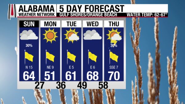
Clouds, patchy fog, and a few light showers greet the coast early today as a strong Arctic cold front sweeps through, followed by clearing skies later this afternoon. Temperatures will fall steadily, with highs near the lower to mid 60s early, then turning sharply colder by evening as north winds increase to 20 to 25 mph with higher gusts. Surf runs 2 to 3 feet with Gulf water temperatures in the lower 60s. Rip current risk is low along Alabama beaches but moderate to high across parts of the Florida Panhandle, especially west-facing beaches. A Cold Weather Advisory is in effect tonight, and marine conditions deteriorate this afternoon with Small Craft Advisories and a Gale Warning offshore.
TODAY IN WEATHER HISTORY
December 14, 1987 – Tragedy Averted
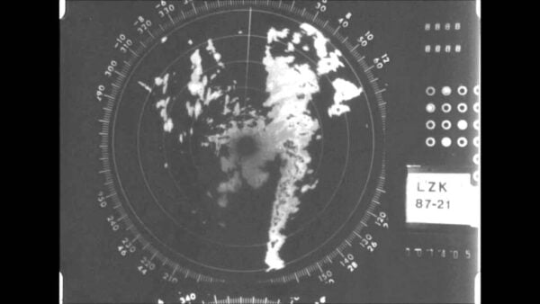
On December 14, 1987, a destructive F3 tornado developed four miles southwest of West Memphis, Arkansas, and raced northeast at 60 mph. Over its 12-mile path in Crittenden County, it destroyed or heavily damaged 235 homes and 35 businesses, leaving 1,500 residents homeless and severing major power lines that blacked out the entire county. The tornado missed the packed Southland dog track, where 6,000 to 7,000 people were in attendance, by only a few hundred yards, avoiding what could have been a mass-casualty disaster. The storm then crossed the Mississippi River into Shelby County, Tennessee, causing major destruction in the Northhaven area, where 30 homes were destroyed and nearly 200 more were damaged. Six people were killed and 121 injured, with fatalities documented by Thomas Grazulis occurring in a mobile home, a boarding house, a parking lot, an apartment building, a vehicle thrown from I-40, and a truck stop. The tornado finally lifted near Millington after a 25-mile path that underscored the Mid-South’s vulnerability to strong winter tornadoes.
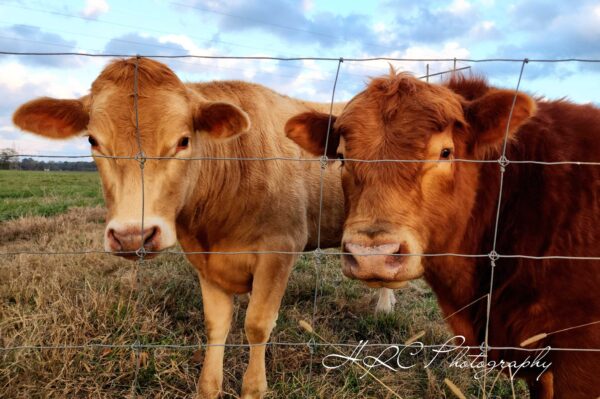
IMAGE OF THE DAY
Heather Cofield sent in this photo of beautiful bovine friends from Alexandria in Calhoun County Saturday evening.



