


Daily Weather Briefing
Sunday, February 1, 2026
ALABAMA YESTERDAY
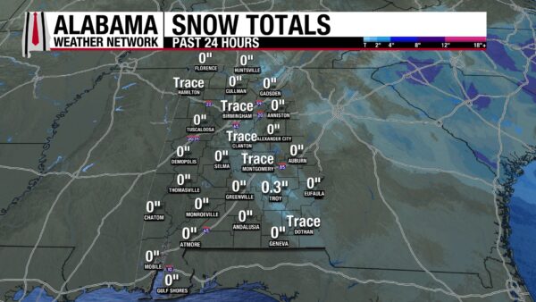
Many Alabamians woke to snow showers yesterday morning. They began early Saturday morning and continued into the early afternoon. Snowfall amounts ranged from a trace to a surprising 0.3” in Troy. Along with the snow, winds were very strong, gusting consistently from 20-30mph throughout the day. There were times in most locations throughout the state in which gusts of 40+ were recorded. Highs ranged from the upper 20s north, low to mid 30s centrally, and upper 30s to low 40s south. With the blustery winds, however wind chills were often 10-15 degrees below the actual temperature.
ALABAMA THIS MORNING
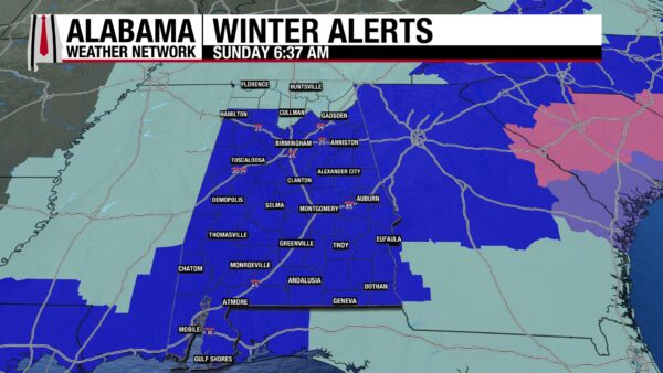
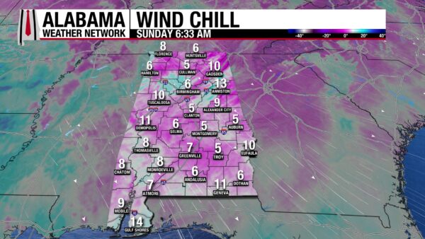
A few flurries have flown in north and central Alabama this morning, but not enough to see accumulation. Temperatures are in the mid to upper teens across the state, except for Geneva and Gulf Shores, which sit at 21 and 23 degrees respectively. Although winds are not gusting as strongly as they were yesterday, the state is still breezy. This is bringing our wind chill temperatures to the single digits and low teens. This is why northern Alabama is under a Cold Weather Advisory (light blue), and the rest of the state is under an Extreme Cold Warning (bright blue) until noon. It is bitterly cold this morning, so if you have to go outside, please bundle up!
ALABAMA 7 DAY FORECAST
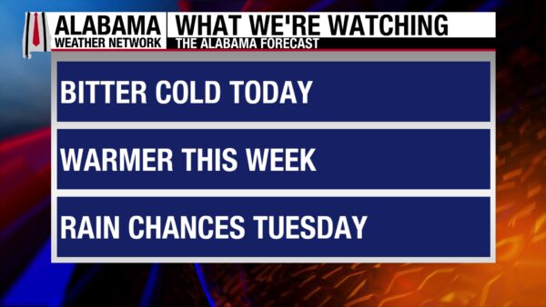
Today will be cold, but winds will finally begin to calm. High-pressure settles in, allowing for warming Monday and Tuesday. Tuesday afternoon through Wednesday, we’ll see increased rain chances associated with a cold front. Wednesday and Thursday will be cooler, before Friday and Saturday moderate.
COLD SUNDAY
Today will be cold, with highs in the mid to upper 30s north, low 40s in central and south-central Alabama, and the upper 40s along the coast. Winds will finally decrease throughout the day, so the difference between the actual and wind chill temperature will decrease this afternoon. Skies will be mostly clear until sunset, when clouds move in from the west.
ANOTHER CHILLY NIGHT
Lows will fall to the low 20s, except for coastal Alabama, where the upper 20s and low 30s will be recorded. Winds will still be light, and skies will be partly cloudy.
MODERATING BEGINS MONDAY
As the high-pressure system settles into the region, clear skies and light winds will allow warmer temperatures. Highs Monday are expected to be in the upper 40s to low 50s north and mid 50s farther south.
WARMER TUESDAY
Tuesday, highs will reach the mid to upper 50s north, low 60s centrally, and mid 60s in the south. Rain will begin to move in from the northwest in the afternoon, tracking southeast throughout the night. A few rumbles of thunder or thunderstorms could occur toward the south. Rainfall amounts are not expected to exceed half an inch.
COOLER WEDNESDAY AND THURSDAY
A cold front will be driving the rain, and as it passes through the state, it will leave behind cooler temperatures. Wednesday, highs will reach the mid 40s north, upper 40s to mid 50s in central Alabama, and the upper 50s to low 60s in the south. Thursday will be even cooler as all the cold air will have reached the state. Highs will range from the lower 40s north to the lower 50s south.
WARM-UP FRIDAY AND SATURDAY
Luckily, the cold will not have too strong a grip this time. Highs Friday will reach the upper 40s in the far north, the mid to upper 40s in north-central Alabama, and the low 60s farther south. Saturday will be even warmer, with highs in the upper 50s low 60s north, the mid 60s centrally, and upper 60s in the south.
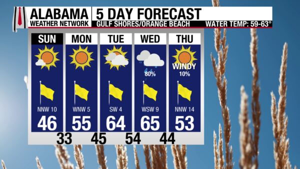
ANOTHER CHILLY BEACH DAY
The beach is still very cold today, with a high in the mid 40s. Winds will blow from 10 to 15 mph, keeping temperatures feel colder. The skies will be sunny, and the rip current risk is low. If you’re craving a day for a walk, Tuesday will be your best bet!

WEATHERBRAINS 1046
Tomorrow’s WeatherBrains episode will talk about the OTUS Project, a student-founded non-profit research mission that investigates tornadoes. Listen to the episode to get an insider’s look into the research happening in the field of meteorology every day.

TODAY IN WEATHER HISTORY
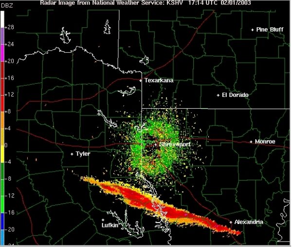
February 1, 2003 – The Day Columbia Was Lost
On February 1st, 2003, a tragedy took place as the Space Shuttle Columbia attempted to land in Florida. The mission was to complete several science experiments in space that could not give us the same insight if they were done on earth. When the shuttle launched 16 days prior, a piece of foam insulation broke off and hit the edge of the shuttle’s left wing. It was noted that it could cause catastrophic failure, but little could be done about it while they were in space. At 8:53 a.m. as the shuttle re-entered the earth’s atmosphere, wind and heat entered the damaged wing and caused the shuttle to spiral and break apart as it soared over California. By the time it was over Texas, the shuttle exploded, spreading the debris across Texas, Louisiana, and Arkansas. The crew, Rick Husband, commander; Michael Anderson, payload commander; David Brown, mission specialist; Kalpana Chawla, mission specialist; Laurel Clark, mission specialist; William McCool, pilot; and Ilan Ramon, payload specialist, perished. The entire NASA program was grounded for two years afterward to address safety concerns.
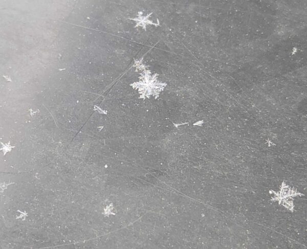
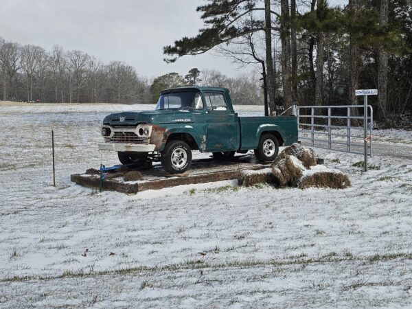
IMAGE(S) OF THE DAY
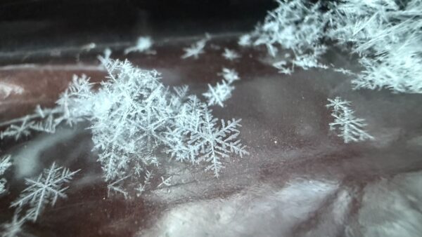
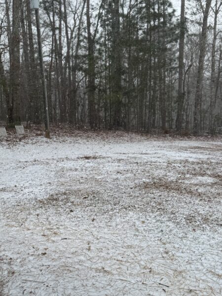
Our images of the day come from some of our helpful Skywatchers!
1. Daniel Harbin – snowflakes on his truck in Trenton this morning.
2. Lane Kilgore – dusting of snow on grass in Rosewood yesterday.
3. Kristian Hanner – snowflakes in Roanoke from yesterday.
4. Brent Luker – field and truck covered in snow in Mentone yesterday.



