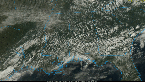
WARMEST SO FAR: Temperatures are in the 78-82 degree range across most of Alabama this afternoon… it is the warmest day so far this year. We have a mix of sun and clouds, and showers are almost impossible to find on radar.
TOMORROW/SATURDAY: A surface front will move into Alabama after midnight tonight; it will drift down into the central part of the state by midday tomorrow where it stalls. Then, it moves northward tomorrow night as a warm front. And, on Saturday, it moves south again as a cold front. This “windshield wiper” effect will bring a series of showers and a few storms.
Showers will increase over North Alabama late tonight and during the pre-dawn hours… then they will move into the southern counties of the state during the day tomorrow. Rain will increase again over the northern part of the state late tomorrow afternoon into early Saturday morning. Then, by Saturday afternoon, the main risk of rain will shift south again into the southern half of the state.
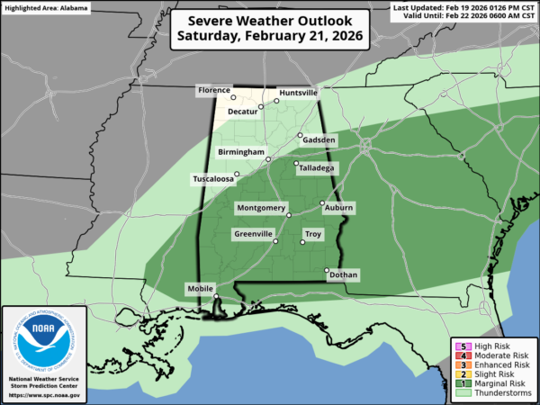
SPC has defined a low end “marginal risk” of severe thunderstorms for parts of South and Southeast Alabama Saturday afternoon… the air will be somewhat unstable ahead of the front, and a few strong storms could form mainly south and east of Montgomery. But the overall risk is low.
Rain amounts will be generally 1/2 inch or less for most communities between now and Saturday night.
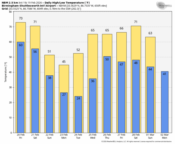
COLD AIR RETURNS: Sunday will be mostly sunny, breezy, and much colder with a high in the 48-58 degree range. A freeze is likely early Monday over the northern half of the state… by Tuesday morning temperatures will drop into the 20s deep into South Alabama.
A warming trend begins Tuesday afternoon, and by the end of the week South Alabama will see highs in the low 70s. Global models suggest rain and possibly a few thunderstorms will return by Thursday ahead of a cold front. See the video briefing for maps, graphics, and more details.
ON THIS DATE IN 1884: The 1884 Enigma outbreak is thought to be among the largest and most widespread tornado outbreaks in American history, striking on February 19–20, 1884. As the precise number of tornadoes as well as fatalities incurred during the outbreak are unknown, the nickname “Enigma outbreak” has come to be associated with the storm. Nonetheless, an inspection of newspaper reports and governmental studies published in the aftermath reveals tornadoes (or more likely — long-track tornado families) striking Alabama, Georgia, Illinois, Indiana, Kentucky, Mississippi, North Carolina, South Carolina, Tennessee and Virginia, with an estimation of at least 50 tornadoes.
In Alabama these tornadoes affected at least eight separate counties across the state from around midday until late evening, resulting in at least 39 fatalities and 116 injuries.
Look for the next video briefing here by 6:00 a.m. tomorrow…