


RADAR CHECK: We have a few scattered showers and thunderstorms over the southeast corner of the state this afternoon (Houston, Geneva, and Henry counties), but the rest of the state is warm and dry with temperatures generally in the 78-84 degree range. Some cities are very near record high temperature levels for March 5. Scattered storms across Southeast Alabama end this evening, otherwise tonight will be mostly fair with a low between 58 and 65 degrees.
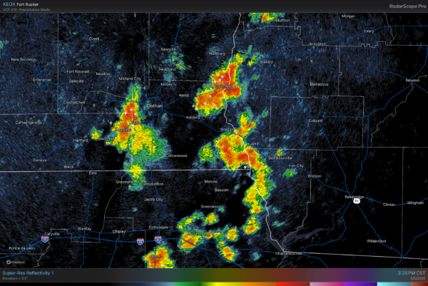
Tomorrow we will mention the chance of random, widely scattered, mostly afternoon and evening showers statewide; chance of any one spot seeing rain is 25-30 percent. Much like a summer day.
THE ALABAMA WEEKEND: Saturday morning will be dry, but an area of showers and a few thunderstorms will push into the northwest part of the state during the mid to late afternoon hours ahead of a surface front. This activity will move slowly southward Saturday night and weaken. SPC has introduced a low end “marginal risk” (level 1/5) of severe thunderstorms for the northern 3/4 of Alabama.
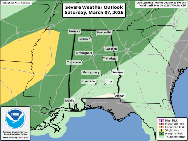
Severe weather parameters are not really impressive with meager instability and weakening upper support, but as always we will watch any storms closely.
The front will stall near the northwest corner of Alabama, and we will mention the chance of scattered showers and thunderstorms Sunday. Not raining all day, and not necessarily raining everywhere. Sunday’s high will be in the 70s for most communities.
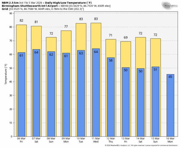
NEXT WEEK: While a few isolated showers will be possible, most of Monday and Tuesday should be dry and warm. A cold front will bring another round of showers and storms to Alabama Wednesday night and early Thursday. Strong thunderstorms are certainly possible, but it is too early to know if we have any risk of severe storms. Cooler air will follow the front with highs in the 65-75 degree range late in the week. See the video briefing for maps, graphics, and more details.
ON THIS DATE IN 1963: A violent F4 tornado touched down in the southwest part of Bessemer and then moved through the downtown area. From there it then moved to the northeast through parts of Homewood and Mountain Brook. Most of the damage was in the first 2 miles of the tornado’s path in Bessemer. There were 35 injuries and no fatalities; 200+ buildings were damaged, 29 were destroyed, and 25 had major damage.
ON THIS DATE IN 1989: An F2 tornado moved from near Childersburg to Talladega. 21 mobile homes were destroyed. Two houses were destroyed, and 77 houses were damaged. Several businesses, a car dealership, and a hospital received major damage. Two people were injured. Other tornadoes touched down that day near Mount Olive, Brundidge and Lafayette.
Look for the next video briefing here by 6:00 a.m. tomorrow…



