


RADAR CHECK: The band of snow that moved across the northern half of Alabama this morning is well to the east, but we still have a few lingering flurries over the northeast corner of the state this afternoon. Elsewhere the sky is clearing with temperatures in the 30s and 40s. Tonight will be clear and cold, and a freeze is likely pretty much statewide early tomorrow morning. Lows will be generally in the 20s; only southern Baldwin and Mobile counties will escape a freeze (we expect mid 30s there).
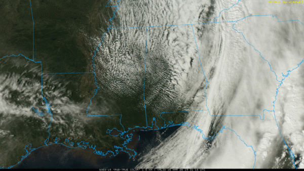
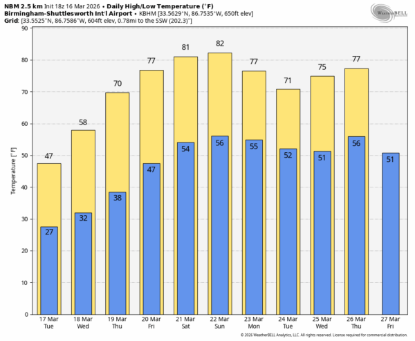
Another freeze is likely early Wednesday morning over the northern half of the state, then a warming trend begins Wednesday afternoon. By the time the weekend gets here, we expect highs in the 80-85 degree range across the state. The air stays dry and we expect no rain after today through Sunday.
Next week is looking generally dry and mild… See the video briefing for maps, graphics, and more details.
ON THIS DATE IN 1973: Five tornadoes touched down across Alabama, including an F2 that hit the Pelham area shortly after noon and stayed on the ground for approximately three miles. Most of the damage at Pelham was to a mobile home sales lot. The north wing of a shopping center containing about 6 shops was also heavily damaged. There were 5 minor injuries reported.
Look for the next video briefing here by 6:00 a.m. tomorrow…



