


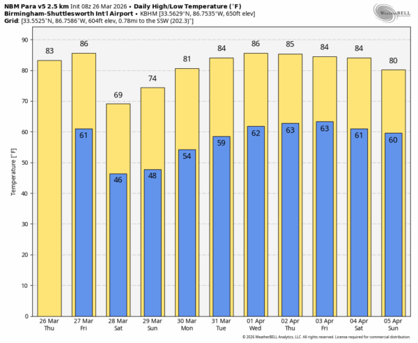
BACK TO THE 80s: The weather will be warmer across Alabama today and tomorrow with highs in the 80s statewide. Expect a partly to mostly sunny sky both days. But, a cold front will push through the state tomorrow night, and we will mention the chance of a few spotty showers over the northern third of the state ahead of the front tomorrow evening. Rain amounts will be light and spotty.
The weather will be cooler over the weekend. Look for sunshine in full supply both days; the high Saturday will be in the 65-75 degree range, afternoon temperatures will be in the 70s statewide Sunday.
NEXT WEEK: Highs return to the 80s through most of the week. Moisture levels will rise a bit, and there could be a day or two with isolated showers. But, with an upper ridge overhead the chance of a big rain event is low… See the video briefing for maps, graphics, and more details.
ON THIS DATE IN 1948: An F4 tornado hit Coatesville, IN killing 19 and injuring 200. About 40 farms were torn apart across Putnam County. About 80 percent of the town of Coatesville was destroyed by the large tornado.
ON THIS DATE IN 2009: An EF-0 tornado touched down on Alabaster. The track started near the intersection of Kent Dairy Rd. and County Road 17 just north of Maylene, causing sporadic damage as the storm moved to the east. The end of the damage path is on the east side of Interstate 65 near exit 238. Numerous trees were snapped and uprooted and three homes were damaged along the path from trees falling on them.
Look for the next video briefing here by 3:00 this afternoon… enjoy the day!



