


MOSTLY DRY TODAY: Showers will be very hard to find across Alabama today… with a partly sunny sky temperatures rise into the low to mid 80s this afternoon. Tomorrow will also be warm and generally dry with only isolated afternoon showers.
THE WEEKEND: An organized batch of showers and storms will move into the state tomorrow night; SPC has a small part of West Alabama in a low end “marginal risk” (level 1/5) of severe thunderstorms…
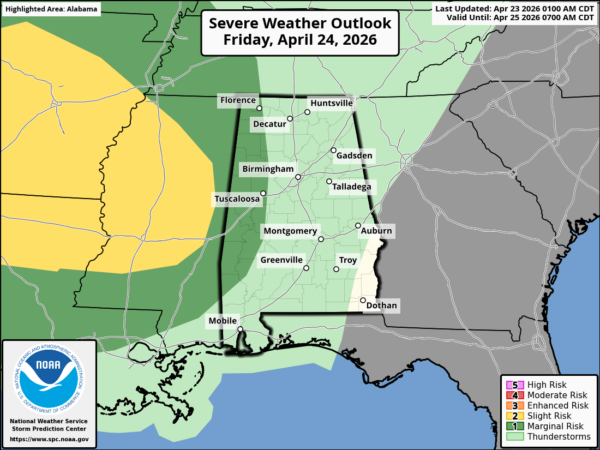
Storms could produce strong, gusty winds as they initially move into West Alabama tomorrow night, but the overall threat of severe storms is relatively low. This area of rain and storms will move out of the state Saturday morning, and Saturday afternoon will be much drier, although widely scattered showers will be possible.
Sunday looks generally dry and warm with just a small risk of any one spot seeing a shower. Highs over the weekend will hold in the 80-84 degree range for most communities.
NEXT WEEK: An active, unsettled pattern is setting up next week for Alabama and the Deep South. Multiple rounds of showers and thunderstorms are likely, and we could very well see the threat of severe storms along the way. The first round will come Monday night into Tuesday; SPC continues to trim the severe weather risk for Alabama Monday night… now just the northwest corner of the state is included.
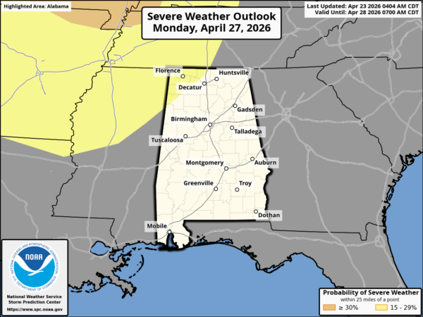
There is no formal severe risk defined for Tuesday at this point, but that could change. Global models suggest the highest threat of strong to severe thunderstorms will come Tuesday, and then again at some point later in the week (most likely Thursday). It is too early to be specific about the magnitude of any severe weather threat, or the timing. See the video briefing for maps, graphics, and more details.
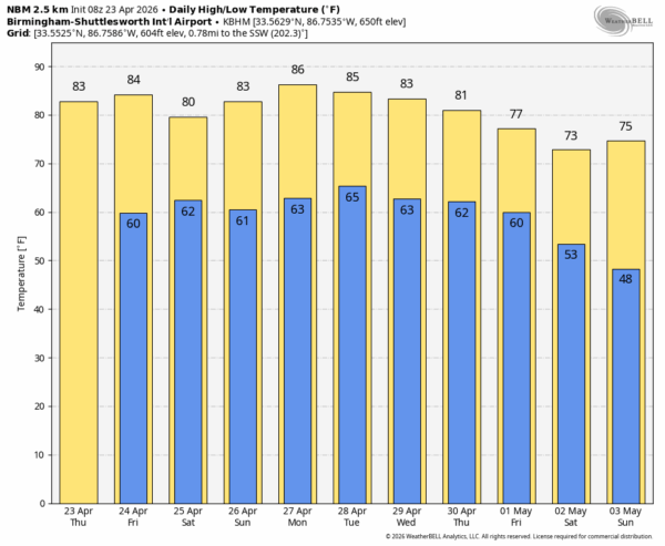
RACE WEEKEND: Tomorrow will be warm and dry at Talladega with a high in the mid 80s. Showers are likely Saturday morning, but by afternoon the weather will be much drier with only spotty showers around. Saturday’s high will be close to 80 degrees after a morning low near 60. Then, for the Jack Link’s 500 on Sunday, the weather is looking good… a partly sunny sky, just a small risk of a shower, and afternoon highs in the mid 80s.
ON THIS DATE IN 1971: A violent F4 tornado touched down just east of Monroeville… it moved through rural parts of Monroe and Butler counties. Near total destruction occurred along the first 10 miles of the tornado path.
Look for the next video briefing here by 3:00 this afternoon… enjoy the day!



