


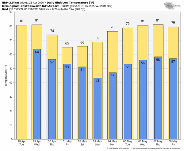
RADAR CHECK: Rain and thunderstorms continue across much of North Alabama early this morning. Storms remained below severe limits through the night, but they are producing heavy rain, gusty winds, and loud thunder. Rain will diminish as it moves southward; temperatures will rise into the low 80s in most places this afternoon.
Another round of storms will roll into the state late this afternoon and tonight; SPC has defined a “slight risk” (level 2/5) of severe thunderstorms for much of Alabama… north of a line from Uriah to Troy to Auburn.
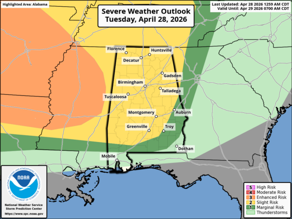
A fast moving band of storms will move into West Alabama late this afternoon, around 5:00-6:00.. the main concern will come from strong, potentially damaging straight line winds. A brief, isolated tornado or two can’t be ruled out over the western third of the state, but wind is the main concern…. storms should weaken after midnight as they move quickly into East and South Alabama.
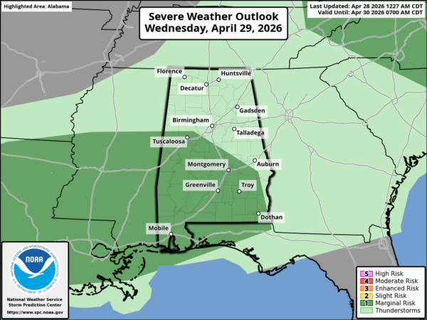
Most of the day tomorrow will be dry with a high in the low 80s. Then, suggest another area of rain and thunderstorms will move through the southern 2/3 of the state late tomorrow and tomorrow night; there is only a low end “marginal risk” (level 1/5) risk of severe storms over the southern half of the state.
THURSDAY/FRIDAY: As a surface front moves into far South Alabama, we expect a cooling trend. By Friday highs will be in the 60s over the northern half of the state. Any showers Thursday/Friday should be confined to the southern quarter of the state.
THE ALABAMA WEEKEND: A wave of low pressure will form along the front, and the latest global model data suggests we will need to forecast a good chance of rain at times statewide Saturday. For now it looks like the highest rain coverage Saturday will come during the morning hours. Sunday looks dry and pleasant with a high in the 70s. See the video briefing for maps, graphics, and more details.
ON THIS DATE IN 2014: A total of 29 tornadoes touched down in Alabama, including an EF3 tornado that moved from southeast of Rogersville into Athens, resulting in 2 fatalities. An EF-1 moved through the southern part of Tuscaloosa, injuring 13 people. An EF-3 moved through Lee County south of I-85… a total of 13 injuries were also reported there.
Look for the next video briefing here by 3:00 this afternoon… enjoy the day!



