


RADAR CHECK: Most of Alabama is dry this afternoon with sun filtered by high cirrus clouds, but some scattered light rain is over South Alabama. Most of the state will be dry tonight with lows in the 52-62 degree range.
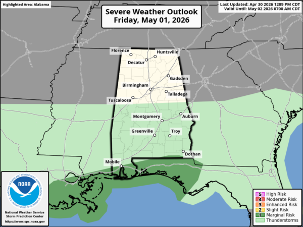
Clouds will increase tomorrow, and rain will move back into the state tomorrow afternoon over the western counties. Rain will be widespread tomorrow night as a wave of low pressure moves along the stalled front. A few thunderstorms are possible near the coast, but the risk of severe storms at this point looks low. Still, SPC has defined a “marginal risk” (level 1/5) for southern Mobile and Baldwin counties, and across the Florida Panhandle.
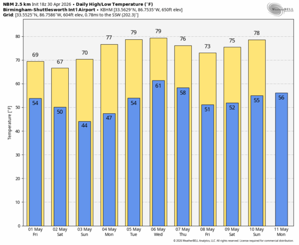
THE WEEKEND: Rain will end early Saturday morning from the northwest, and most of Alabama will be dry during the day with a clearing sky. Expect a high in the 65-72 degree range.
Sunday will be a sunny day with a cool morning… a few colder spots over North Alabama could dip into the upper 30s early Sunday morning. The high will be in the low to mid 70s.
NEXT WEEK: The weather will be dry Monday and Tuesday with a warming trend. The latest global model data suggests we will have a chance of rain Tuesday night and Wednesday with no risk of severe storms. See the video briefing for maps, graphics, and more details.
ON THIS DATE IN 2005: A pre-dawn EF-1 tornado moved through Shelby County; it impacted parts of Helena, Alabaster, Pelham and Chelsea. Several subdivisions were affected including Braelinn Village, Amberley Woods, Navajo Hills,Port South, and Weatherly. Numerous homes suffered shingle and minor roof damage along with a few broken windows. Many trees and power lines were either blown down or snapped off.
Look for the next video briefing here by 6:00 a.m. tomorrow…



