


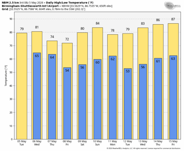
MOSTLY DRY TODAY: Most of Alabama will stay rain-free today, although a few spotty showers are possible near the Tennessee state line this afternoon. Most communities will see a high today near 80 degrees.
An approaching cold front will bring an organized band of showers and thunderstorms into Alabama and the Deep South late tomorrow and tomorrow night. SPC maintains a level 2/5 risk of severe thunderstorms over roughly the northern half of the state, and a level 1/5 risk as far south as Citronelle, Georgiana, and Phenix City.
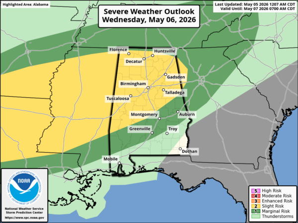
Strong, potentially damaging straight line winds are possible with a line of thunderstorms that will move through the northern half of the state, along with the potential for a few isolated tornadoes. Highest tornado potential will be in any discrete cells that form ahead of the line, especially over West-Central Alabama.
The primary window for strong to severe thunderstorms over the northern half of Alabama will come from about 5:00 p.m. until 1:00 a.m. Storms will weaken during the pre-dawn hours Thursday.
During the day Thursday most all of the showers and storms will be confined to the southern half of the state, where SPC maintains a “marginal risk” (level 1/5).
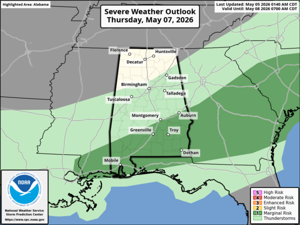
North Alabama will be dry and cooler Thursday with a high in the low 70s. The front will become nearly stationary along the Gulf Coast Friday; we will maintain a chance of rain at times over South Alabama Friday and Friday night.
On the positive side, beneficial rain is likely over the latter half of the week, with most Alabama communities seeing 2-4 inches of rain.
THE ALABAMA WEEKEND: Much of Alabama will be dry Saturday with a high around 80 degrees, but a few spotty showers remain possible over the far southern part of the state. Then, on Sunday, we will mention a chance of showers statewide with a high in the low to mid 80s.
A few showers remain possible Monday, but dry air returns to the Deep South for the middle part of next week. See the video briefing for maps, graphics, and more details.
ON THIS DATE IN 1933: Early in the morning of May 5, 1933, a tornado that was at times a third of a mile wide swept through Bibb and Shelby counties. It carved a track 35 miles long, and killed 20 people as they slept. More than 150 people were injured in Helena, where rescue efforts were hampered by the darkness and the heavy rains that followed the twister. Another tornado the same day killed four people at Demopolis.
Look for the next video briefing here by 3:00 this afternoon… enjoy the day!



