


RADAR CHECK: A band of light rain is moving over the eastern half of the Tennessee Valley this afternoon, otherwise the sky is generally sunny across Alabama with temperatures in the 75-82 degree range. The weather will be mostly dry across Alabama tonight, but high resolution models show some light rain moving back into the northern quarter of the state after midnight.
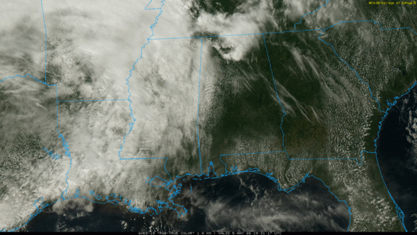
TOMORROW: Rain and a few thunderstorms are possible through the day over the northern quarter of the state; the rest of Alabama will be dry during the day with clouds on the increase.
SEVERE THUNDERSTORM THREAT: An approaching cold front will bring an increase in thunderstorm coverage and intensity tomorrow afternoon and tomorrow night. SPC has now defined an “enhanced risk” (level 3/5) of severe thunderstorms for parts of North/Central Alabama, including places like Birmingham and Tuscaloosa. A level 2/5 risk covers the rest of the northern half of the state, and a level 1/5 risk extends as far south as Citronelle, Evergreen, Troy, and Phenix City.
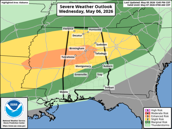
Thunderstorms over North Alabama could produce strong winds by late afternoon (after 4:00 p.m.)… and a tornado threat will likely evolve after dark as a low level jet increases across the region. Highest probability of tornadoes is in the enhanced risk area.
Storms will likely weaken after 1-2 a.m. during the pre-dawn hours Thursday as they move slowly southward.
During the day Thursday most all of the showers and storms will be confined to the southern half of the state, where SPC maintains a “marginal risk” (level 1/5).
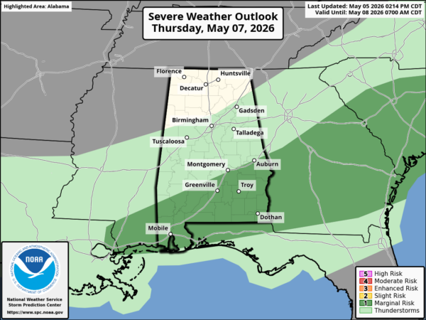
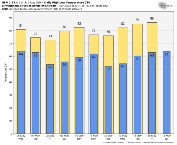
North Alabama will be dry and cooler Thursday with a high in the low 70s. The front will become nearly stationary along the Gulf Coast Friday; we will maintain a chance of rain at times over South Alabama Friday. A wave of low pressure has potential to push rain up into Central Alabama Friday night.
On the positive side, beneficial rain is likely over the latter half of the week, with most Alabama communities seeing 2-4 inches of rain.
THE ALABAMA WEEKEND: Much of Alabama will be dry Saturday with a high around 80 degrees, but a few spotty showers are possible. Then, on Sunday, we will bring in a good chance of showers and thunderstorms statewide with a high in the low 80s.
A few showers remain possible Monday, but dry air returns to the Deep South for the middle part of next week. See the video briefing for maps, graphics, and more details.
ON THIS DATE IN 1933: Early in the morning of May 5, 1933, a tornado that was at times a third of a mile wide swept through Bibb and Shelby counties. It carved a track 35 miles long, and killed 20 people as they slept. More than 150 people were injured in Helena, where rescue efforts were hampered by the darkness and the heavy rains that followed the twister. Another tornado the same day killed four people at Demopolis.
Look for the next video briefing here by 6:00 a.m. tomorrow…



