


RADAR CHECK: A band of showers and storms, some with heavy rain, continues to drop slowly southward through South Alabama early this morning. There is still some chance storms could reach severe limits over the next few hours; the main threats will come from strong winds. A brief isolated tornado can’t be ruled out across Southeast Alabama through mid-morning.
There is some lingering rain over North Alabama early this morning in the cooler air behind the cold front.
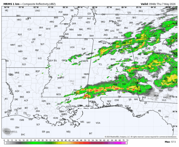
All of the rain will be over by late morning, and the afternoon should be dry with potential for some sun. Highs will range from the low 70s across North Alabama, to the low 80s for the far southern counties of the state.
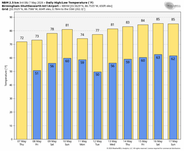
TOMORROW AND THE WEEKEND: Most of Alabama will be dry tomorrow, but a few spotty showers are possible along the coast. We will mention a chance of rain tomorrow night over the southern half of the state as a wave of low pressure forms along the stalled front.
For the weekend, we will need to mention a chance of showers, and possibly a few thunderstorms, mainly over the southern half of Alabama Saturday and Sunday. For now the chance of rain over the northern counties looks low; afternoon highs will be in the upper 70s and low 80s.
NEXT WEEK: Most of the state will be dry Monday… just a small chance of a stay shower. Tuesday will be a sunny day, then we will mention a chance of showers over North Alabama Wednesday thanks to an approaching upper trough. For now Thursday and Friday look rain-free… See the video briefing for maps, graphics, and more details.
ON THIS DATE IN 1960: An F2 tornado tore through parts of Mobile County. It moved from near Belle Fontaine to Hollingers Island…two service stations, a general store, a skating rink, and a lodge hall were destroyed. Major damage also occurred at a church.
Look for the next video briefing here by 3:00 this afternoon… enjoy the day!



