


DRY MORNING: Colder spots across North Alabama are in the upper 40s early this morning… the rest of the state is starting the day in the 50s and low 60s. Expect a mix of sun and clouds today, and showers and storms will likely develop this afternoon over the southwest part of the state. Rain will expand northward late tonight into the central counties of the state.
We note SPC has defined a low end “marginal risk” of severe thunderstorms this afternoon and tonight for areas south of a line from Aliceville to Luverne to Geneva.
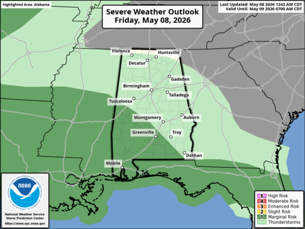
A few storms could produce small hail and gusty winds. There is a low end of a brief tornado or waterspout near the Gulf Coast.
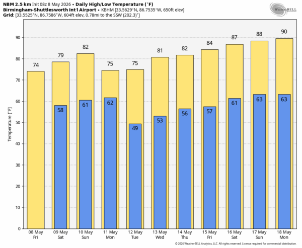
THE WEEKEND: The northern third of Alabama will be generally rain-free tomorrow and Sunday with just a few small isolated showers. But to the south there will be a few periods of rain both days (along and south of I-20). A few thunderstorms will be involved, possibly strong ones over the southern third of the state. But the weekend won’t be a wash-out; highs will will mostly in the upper 70s and low 80s.
NEXT WEEK: A few showers are possible Monday, but the rest of the week looks generally dry with just a small risk of a shower over North Alabama Wednesday. As an upper ridge builds over the latter half of the week afternoons turn warmer… we will be in the upper 80s by the following weekend (May 16-17). See the video briefing for maps, graphics, and more details.
ON THIS DATE IN 1981: Dallas/Fort Worth was hit by their worst hailstorm ever, as baseball to grapefruit sized hail and 100 mph winds caused $200 million in damages. The hail actually accumulated 8 inches deep in Cedar Hill, TX.
ON THIS DATE IN 1973: An F2 tornado moved through parts of Marshall and DeKalb counties, killing two people near Geraldine. The same day another F2 tornado tore through parts of Bankhead National Forest, causing major timber damage.
Look for the next video briefing here by 3:00 this afternoon… enjoy the day!



