


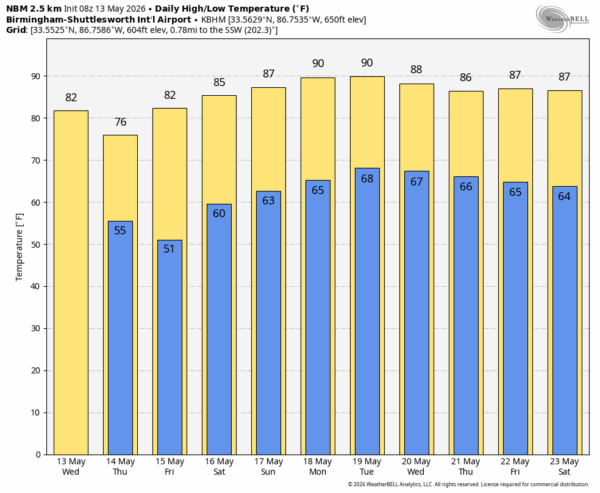
DRY PATTERN: A cold front will move through Alabama late this afternoon and tonight, but with limited moisture and little upper air support, it will pass through the state in generally dry fashion. Any showers this evening will be few and far between; expect a high today in the low 80s.
Tomorrow will be sunny, less humid, and a little cooler with a high between 75 and 80 degrees. Cooler spots across North Alabama will dip into the upper 40s early Friday morning. Then, we warm into the low to mid 80s Friday afternoon with a sunny sky.
THE WEEKEND: The big story is rising heat levels. Temperatures rise into the 84-88 degree range Saturday, and by Sunday afternoon some spots could touch the 90 degree mark. The weekend looks dry at this point although moisture levels will be creeping up Sunday.
NEXT WEEK: Any showers Monday and Tuesday will be hard to find with an upper ridge overhead; afternoon highs will at or just over 90 degrees for most of Alabama. Global models suggest the ridge will weaken over the latter of the week, which will open the door for at least a chance of showers and thunderstorms Wednesday through Friday. See the video briefing for maps, graphics, and more details.
ON THIS DATE IN 1989: A severe thunderstorm produced wind gusts up to 95 mph at Killeen, TX. At Fort Hood, 200 helicopters were damaged.
Look for the next video briefing here by 3:00 this afternoon… enjoy the day!



