


Daily Weather Briefing
Saturday, June 27, 2026
ALABAMA THIS MORNING
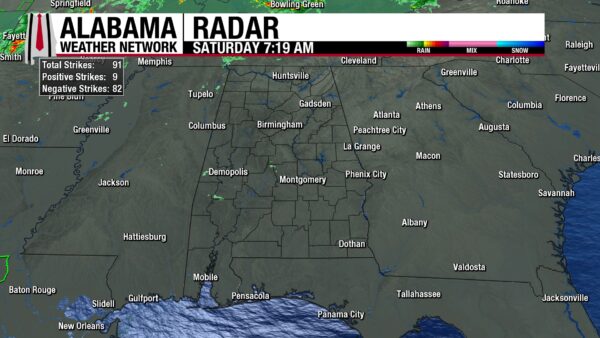
Alabama starts the weekend warm and humid! Temperatures already sit in the mid 70s, and dewpoints do the same. Skies are mostly cloudy across north and central Alabama, while the south sees some clearer skies. Additionally, very light showers sprinkle parts of western south-central Alabama.
ALABAMA 7 DAY FORECAST
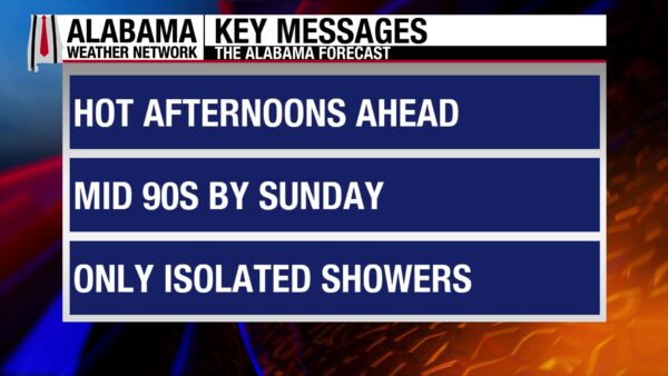
Today will be mostly dry, but northeast Alabama will be wetter, as some strong to marginally storms will move through. Tomorrow will be dry and hot as a high-pressure system and upper-level ridge begins to build over the region. These hot and dry conditions will persist Monday across most of Alabama, except showers and thunderstorms may fire off in the evening. Then a storm system is expected to push through the southeast Monday night. We’ll see more rain coverage Tuesday, with the focus in the southwest and return to an afternoon scattered thunderstorm pattern for the end of the week.
MOSTLY DRY WITH STORMS IN THE NORTHEAST TODAY – June 27
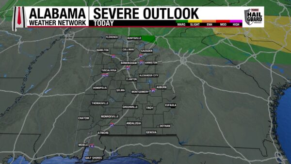
As the ridge begins to build in today, most of Alabama will be dry and hot. A few showers could pop up across the state, but they will be short-lived and sub-severe. Northeast Alabama, however, will see some severe thunderstorms. The Storm Prediction Center has placed the northeast corner of Alabama in a Marginal Risk (1/5) of Severe Thunderstorms today. Storms that become severe will bring a damaging wind and potential hail threat, but tornadoes are not our concern. Highs will hit the lower 90s for the most part, with Cullman, Selma, Clanton, Alexander City, and Auburn clinging to the upper 80s. Skies will be partly cloudy to mostly clear in areas without storms.
DRY AND HOT SUNDAY – June 28
The entire state has only a 10-20% chance of showers tomorrow. Any showers will be isolated and not severe. The main story will be the heat. Highs will manage to climb to the lower to mid 90s statewide. We’ll be cloudy through midday, then skies will clear, allowing the sun to really heat us up. Feels-like temperatures will rise into the upper 90s and even to the mid 100s. Read about heat safety below!
HOT MONDAY, STORMS POSSIBLE SOUTH ON MONDAY – June 29
Another mostly dry day is in store for the northern two-thirds and even much of the southwest on Monday. Skies will again be mostly clear to partly cloudy, and highs will rise to the low to mid 90s. Heat indices (feels-like temperatures) will be impressively hot as they rise to the 100s statewide. We’re expecting to see heat advisories issued for much of the state. The southeast, however, could see a storm complex move through the region Monday afternoon and evening. We’ll be watching the forecast, but as of now, no severe weather is expected.
HEAT CONTINUES TUESDAY, MORE STORMS SOUTH – June 30
The heat will be relentless on Tuesday as highs will easily hit the low to mid 90s, and a few northern locations could see the upper 90s. Feels-like temperatures will reach those low 100 readings possible even before lunch! While the state as a whole deals with another day of heat, the southwest will see some possibly strong showers and thunderstorms in the afternoon. Again, no severe weather anticipated for now, but our eyes are peeled for new updates.
SCATTERED SHOWERS TO END THE WEEK – July 1-3
After interesting rain makers in the south early next week, we’ll return to our usual afternoon shower pattern to end the week. After thunderstorm chances stay at 10-20% statewide Wednesday through Friday. Unfortunately, we’ll see little relief from the heat. The low to mid 90s are expected statewide over those three days, and the north will flirt with the upper 90s each day. Humidity will stay elevated, and heat indices will continue to rise above that 100-degree threshold.
RAINFALL OUTLOOK
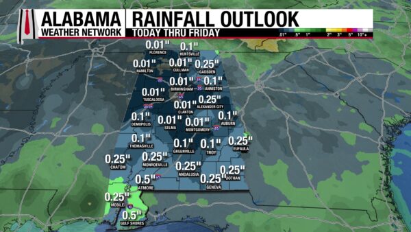
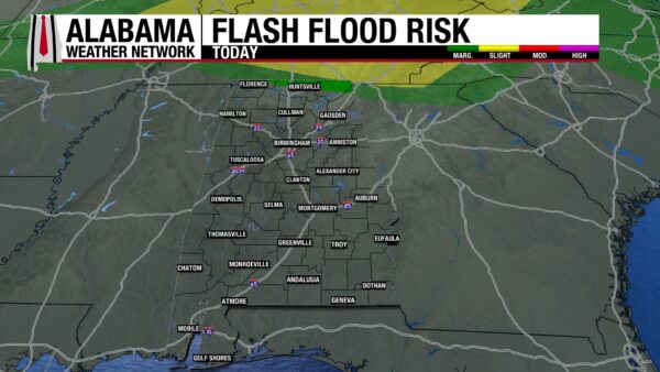
It’ll be a mostly dry week across Alabama, with the highest rainfall amount expected in the southwest at only half an inch. There is a Marginal Risk (¼) for Flash Flooding in the northeast associated with the storms that will move through today.
ALMOST DROUGHT FREE
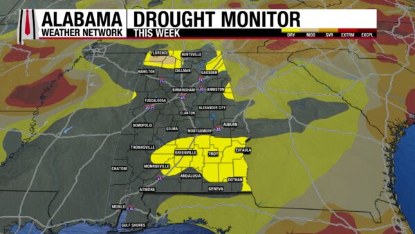
Although the remnants of Tropical Storm Arthur made an interesting weather day last Thursday and caused flooding issues, we can also thank it. The heavy rains made Alabama almost drought free. 74.95% of Alabama is drought free, while 23.25% is in the Abnormally Dry category, and only 1.80% of the state is under a Moderate Drought! The next week will be mostly dry, so it would not be surprising to see the Abnormally Dry conditions spread some. But, because we have been so saturated recently, it won’t be easy.
CHANCES DWINDLE IN THE PACIFIC, NEW AREA IN THE ATLANTIC
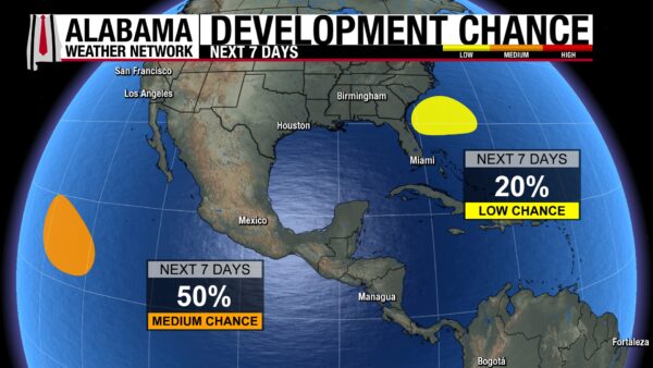
The area of low pressure we’ve been watching in the Pacific this week has seen a decrease in its chance of development to 50%. It could gradually develop over the next seven days, and form into a tropical system by early next week or by midweek. Then it is expected to run into an area less conducive for development. Also, we’re watching an area off the southeast coast that has a 20% chance of development over the next seven days. If it does develop, it will move westward during the next week.
ANOTHER GORGEOUS DAY ON THE COAST
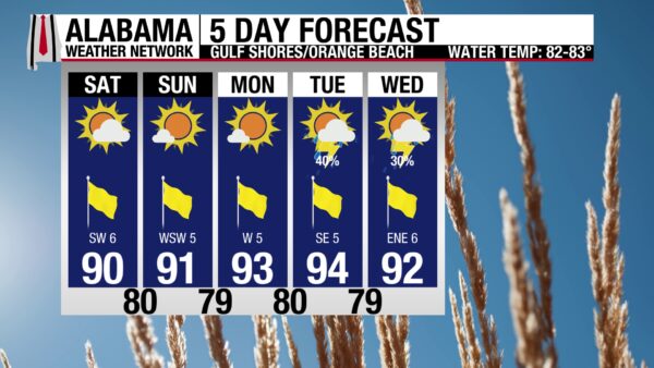
We continue to sit in our stretch of beautiful beach weather today. The high will hit the lower 90s, winds will be from the southwest at 5 to 10 mph, and skies will be sunny. The UV Index will be Extreme, so make sure to apply and reapply sunscreen if out on the sand today. The rip current risk is low and with a wave height of around 1 foot, the ocean will be a nice respite from the sun and heat. These conditions persist through Monday before rain chances pick back up on Tuesday.
TODAY IN WEATHER HISTORY
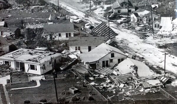
June 27, 1957 – Hurricane Audrey
Hurricane Audrey came ashore in the early morning hours of June 27, 1957, near the remote fishing communities of southwest Louisiana. For many families near the Texas-Louisiana border, the danger the night before had not seemed urgent enough to force a nighttime evacuation. Some residents believed they still had time to leave the next morning. But Audrey was moving faster and strengthening more quickly than expected, and by daybreak the storm was already on the coast.
Audrey intensified violently in its final hours over the Gulf. Its central pressure fell from 973 millibars to about 945 or 946 millibars in roughly 5 hours, with modern National Weather Service analysis listing landfall near Cameron Parish as a strong Category 3 hurricane with winds near 125 mph. Other historical accounts and offshore observations suggested Audrey may have been even stronger. Whatever the exact number, the result was clear: the hurricane generated a storm surge far worse than many residents expected.
The water became the disaster. High-water marks reached 12 to 14 feet across Cameron, Creole and Grand Chenier, and storm tides inundated low-lying areas as far as 25 miles inland. Houses were lifted from foundations and carried away. In Cameron, the courthouse was one of the few structures left standing. Between Cameron and Grand Chenier, much of the built landscape was destroyed, damaged beyond repair, or swept into the marshes and waterways. A 78-ton fishing vessel was even tossed up onto an offshore oil drilling platform.
The human toll was staggering. Older records list 390 confirmed deaths in Louisiana, including 263 identified victims and 127 who were never identified, with another 192 reported missing. Modern summaries generally place Audrey’s total death toll at more than 400 and often at least 500, because many people were swept away by the surge and never found. It was the greatest loss of life from a U.S. hurricane since the 1938 New England hurricane, and it remained unmatched until Hurricane Katrina nearly 50 years later.
Audrey’s damage reached around $130 million to $150 million in 1957 dollars, and its effects continued inland with tornadoes and severe weather, including injuries in Alabama. The deeper controversy came afterward, when survivors and families brought wrongful death lawsuits against the U.S. Weather Bureau, arguing that the warnings had not properly conveyed the storm’s speed, strength or surge danger. The lawsuits failed, but Audrey reshaped hurricane preparedness by exposing how quickly a coastal community can run out of time when rapid intensification and storm surge arrive before morning.
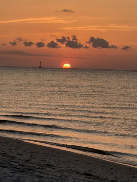
IMAGE OF THE DAY
@KEITHisms81 on X posted this gorgeous photo of the sunset on Dauphin Island West End last night!



