


A FEW STORMS THIS AFTERNOON: Best chance of scattered thunderstorms this afternoon and this evening are over the eastern half of the state. Where they form, like recent days, they will be heavy with potential for strong wind gusts and very frequent lightning. SPC has the northeast corner of the state in a “marginal risk” (level 1/5) today.
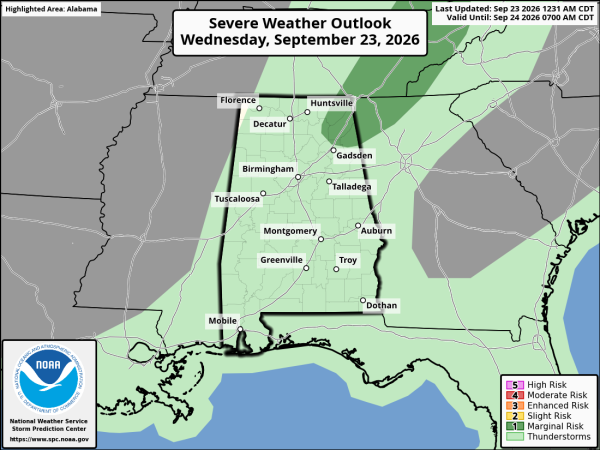
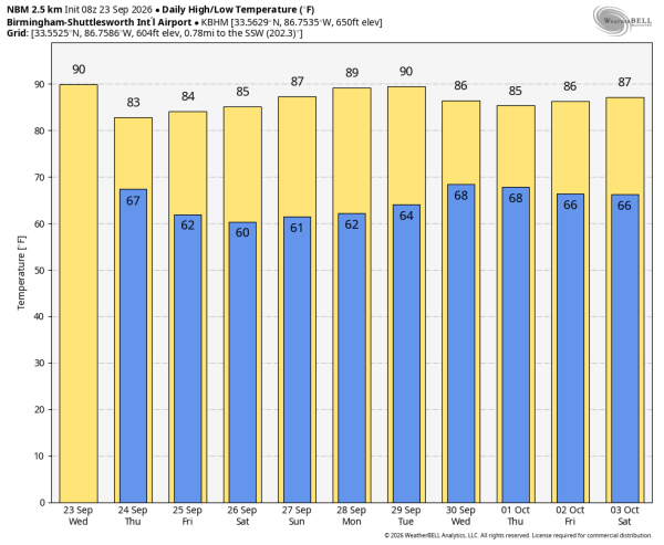
Most of the scattered storms will come from about 1:00 until 9:00 p.m… look for a high this afternoon in the 88-93 degree range for most communities.
COOLER, DRIER: Drier air rolls into the Deep South tonight, and most of Alabama will be rain-free tomorrow through the weekend. Heat levels also come down; highs will be in the low to mid 80s tomorrow and Friday, followed by mid to upper 80s over the weekend. Mornings will be pleasant with lows in the 50s and 60s.
NEXT WEEK: Moisture levels rise, and a few scattered showers/storms are possible Monday and Tuesday. Global models are now giving signals of an organized rain/storm event Wednesday or Thursday… See the video briefing for maps, graphics, and more details.
TROPICS: A tropical wave is about to move off the west coast of Africa. An area of low pressure is expected to form in a day or so, and it could become a short-lived tropical depression tomorrow or Friday. Strong upper-level winds should end the opportunity for development by the weekend.
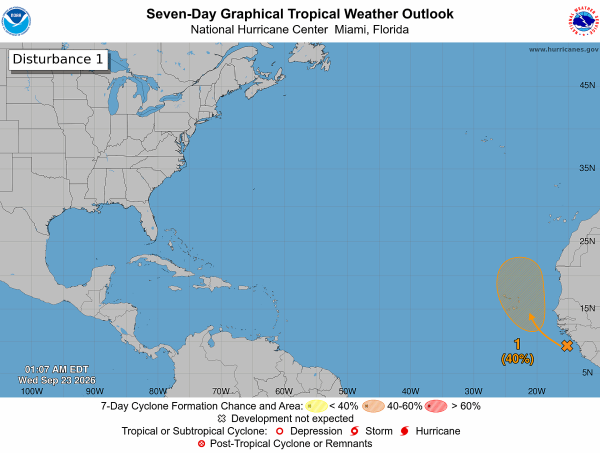
No tropical storms or hurricanes are expected near the U.S. or the Gulf for at least the next 7-10 days.
FOOTBALL WEATHER: UAB has a Friday night special this week… the Blazers host Navy (6:00p CT kickoff at Protective Stadium). The sky will be clear with temperatures falling from near 83 at kickoff into the 70s during the second half.
Auburn hosts Vandy Saturday (3:15p CT kickoff at Jordan-Hare)… the sky will be sunny with temperatures in the low to mid 80s.
Alabama will play South Carolina Saturday night in Tuscaloosa (6:00p CT kickoff at Bryant-Denny)… expect a clear sky with temperatures falling from the low 80s at kickoff into the 70s during the second half.
Jacksonville State, Alabama State, North Alabama, and Samford all have home games; Saturday will be dry statewide with a high in the 80s… temperatures come down into the 70s soon after sunset.
ON THIS DATE IN 1975: Hurricane Eloise made landfall as a major hurricane about 10 miles east of Fort Walton Beach at 7a CT. According to the NOAA Assessment, Herbert Saffir estimated winds in excess of 120 mph based on the structural wind damage he observed. Shortly after Eloise made landfall, a peak wind gust of 115 mph was recorded at Eglin AFB (before the instrument failed) with 85 mph gusts at Hurlburt Field.
Look for the next video briefing here by 3:00 this afternoon… enjoy the day!



