SEVERE CLEAR: Not a cloud in the Alabama sky today; temperatures are approaching 90 degrees in many areas this afternoon. Tonight will be clear and pleasant with a low between 56 and 62 degrees.

FRIDAY AND THE WEEKEND: A cold front will pass through the state Friday night. Moisture will be very limited, and for now we aren’t expecting any meaningful rain with the front. Maybe a brief, isolated shower somewhere across the Tennessee Valley. Much cooler air arrives just in time for the weekend. Expect sunshine in full supply both days with highs in the 70s and lows in the 40s and 50s. It will be a delightful autumn weekend.
NEXT WEEK: For now much of next week looks dry and warmer with afternoon highs back in the 80s. See the video briefing for maps, graphics, and more details.

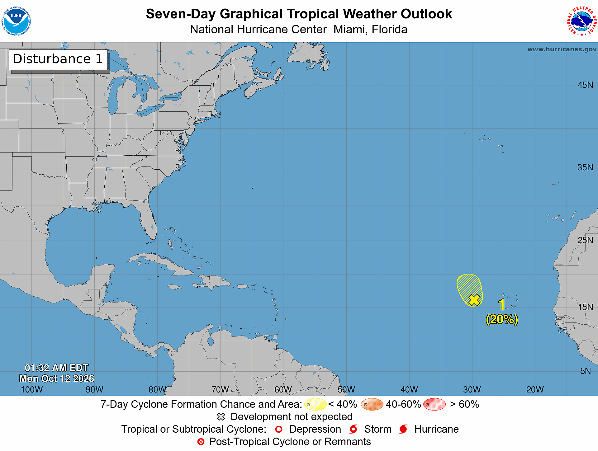
TROPICS: An elongated area of low pressure centered a few hundred miles west of the Cabo Verde Islands continues to produce a large but disorganized area of showers and thunderstorms occurring on its east side, extending toward the westernmost Cabo Verde Islands. Environmental conditions appear, at best, only marginally conducive for development of this system during the next day or so before upper-level winds become too strong for any further development tomorrow.
Chance of development is only 20 percent, and the rest of the Atlantic basin is quiet.

ON THIS DATE IN 1979: The lowest barometric pressure ever recorded on Earth occurs in the center of Typhoon Tip on this day. A fly reconnaissance mission recorded the low pressure of 870 hPa or 25.69 inHg. Typhoon Tip was the largest tropical cyclone on record, with a diameter of 1,380 miles — almost double the previous record of 700 miles in diameter set by Typhoon Marge in August 1951.
Look for the next video briefing here by 6:00 a.m. tomorrow…