


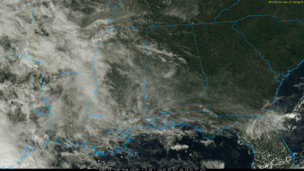
WARM AFTERNOON: Temperatures are between 77 and 82 degrees across Alabama this afternoon with sun through high cirrus clouds. No rain on radar. Clouds will increase tonight.
We will mention a chance of showers statewide over the weekend. A few notes…
*The weekend won’t be a washout. Just expect some rain at times if you have an outdoor event planned.
*Some thunder is possible across the southwest corner of the state tomorrow, but there is no risk of severe thunderstorms. It will be mostly light rain showers.
*Rain amounts will be generally 1/2 inch or less. Highest coverage of rain will likely be late tomorrow night into Sunday.
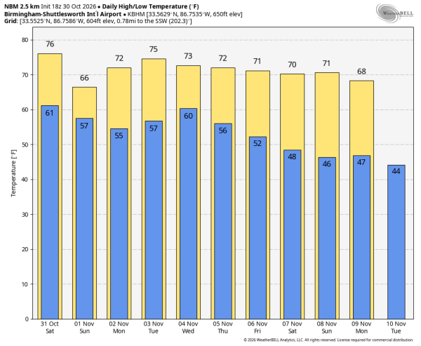
*Expect a high in the 70s tomorrow; Sunday will be cooler with temperatures holding in the 60s over the northern half of the state.
NEXT WEEK: Monday and Tuesday look dry with highs in the 70s. Then, a dynamic system arrives with rain and thunderstorms on Wednesday. Instability will be limited; best chance of strong to severe storms will be over the southern quarter of the state and near the coast. Rain amounts will average around one inch, with heavier amounts in a few spots.
A few lingering showers are possible Thursday, then we expect dry weather for Friday and the weekend (November 6-8) with seasonal temperatures. See the video briefing for maps, graphics, and more details.
TROPICS: All remains quiet across the Atlantic basin; tropical storm formation is not expected for at least the next 7-10 days.
TIME CHANGE: We go back on standard time Sunday; clocks go back one hour late tomorrow night. Sunrise time Sunday is 6:06a CST, sunset will come at 4:55p CST.
FOOTBALL WEATHER: For tomorrow’s Magic City Classic at Legion Field in Birmingham (Alabama State vs Alabama A&M, 2:30p CT kickoff).. we expect a mostly cloudy sky with a risk of showers during the game. Temperatures will be in the mid 70s at kickoff, falling to near 70 by the final whistle.
Auburn will be in Oxford tomorrow to take on Ole Miss (11:45a CT kickoff)… the sky will be mostly cloudy with a chance of showers. Temperatures will be in the low to mid 70s.
South Alabama hosts Louisiana Tech tomorrow afternoon (2:00p CT kickoff)… expect a mostly cloudy sky; a few showers are possible. Temperatures will fall from the upper 70s during the first half into the mid 70s by the fourth quarter.
ON THIS DATE IN 1991: The “Perfect Storm” reached its peak in the North Atlantic. On October 30, 1991, a powerful nor’easter off Nova Scotia absorbed the remains of Hurricane Grace and stalled against a huge high pressure system over eastern Canada. Boston forecaster Robert Case called the alignment “perfect” — three weather systems in the worst possible places at the worst possible time. Squeezed between the storm and that high, the pressure gradient built monstrous seas. A buoy south of Halifax measured a wave 100.7 feet high, the largest ever recorded there. Waves of 10 to 30 feet pounded the coast from North Carolina to Nova Scotia.
Look for my next video briefing here by 6:00 a.m. Monday… enjoy the weekend!



