


Daily Weather Briefing
Saturday, October 31, 2026
ALABAMA THIS MORNING
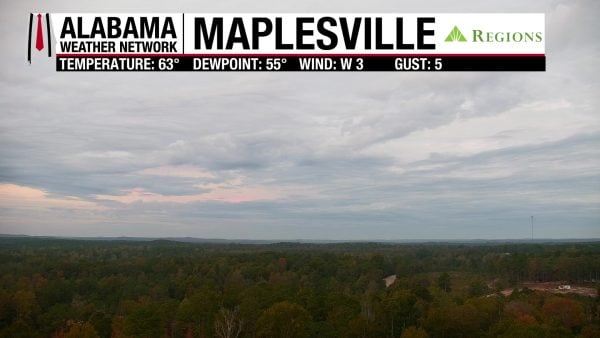
Temperatures are warmer than they’ve been recently, with the low to mid 60s spreading across the state. Our Regions Skycam in Maplesville shows the gloomy morning everyone is waking to, with overcast skies.
ALABAMA 7 DAY FORECAST
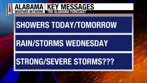
Our dry, benign weather pattern gives way to a more active pattern starting today. An upper-level shortwave moves through Alabama today and tomorrow, bringing some rain to the state this weekend. The beginning of next week will be on the drier and quieter side before an upper-level trough pushes a surface low-pressure system through Alabama on Wednesday, bringing more rain and some storms. The week will end dry.
SHOWERS POSSIBLE THIS AFTERNOON – Oct 31
Happy Halloween! Unfortunately, it’ll be a rainy one, but the good news is it won’t be a washed-out Halloween, and no dangerous weather is expected. Moisture will increase throughout the morning, and showers will be possible statewide by this afternoon onward. Most showers should be scattered and relatively light to moderate in nature, but there is a chance for some rumbles of thunder and a few heavier showers in the southwest. If you’re planning on Trick-Or-Treating or have other outdoor plans tonight, just keep an umbrella or raincoat on hand! Highs will be in the upper 70s to low 80s statewide, with evening temperatures falling from the mid 70s into the mid 60s by late tonight.
Rain coverage increases late tonight into Sunday morning, and lows will be in the mid to upper 50s in the northern half of the state and the low to mid 60s in the southern half.
RAIN CONTINUES SUNDAY – Nov 1
We start the new month with our clocks set back an hour (Daylight Saving Time) and rainy. The increased coverage of light to moderate showers and thunderstorms will continue throughout the day on Sunday. Thunder chances diminish, but some heavier showers are still not out of the question. Highs will be much cooler than they’ve been at the end of this week, as the rain and clouds will limit them to the mid 60s north, mid to upper 60s centrally, and upper 60s to low 70s south. Rain chances dwindle toward the evening.
RELATIVELY DRY START TO THE WEEK – Nov 2-3
Low rain chances stick around Monday and Tuesday, with an isolated shower or two possible statewide both days. Monday will start with temperatures in the mid 50s north and the upper 50s to low 60s across the southern two-thirds of the state. Then they will warm to the low 70s north to the upper 70s south in the afternoon. Tuesday morning will see temperatures in the low 60s statewide, then highs will rise into the mid 70s north and the upper 70s over the southern two-thirds of the state.
MORE RAIN, SOME STORMS ON WEDNESDAY – Nov 4
Thanks to the surface low-pressure system and driving upper-level trough, Alabama will see more rain and some storms on Wednesday. It is still early to determine severe weather impacts, if any, as well as timing, but rain, thunder, and lightning will occur on Wednesday. Highs will be in the low 70s in the northern half of Alabama and the mid to upper 70s in the southern half.
QUIET END TO THE WEEK – Nov 5-6
Wednesday’s system pushes a cold front through Alabama, and another dry airmass will filter into the state Thursday and Friday. Highs climb to the low to mid 70s both days. There is a low chance for showers Thursday.
RAINFALL OUTLOOK
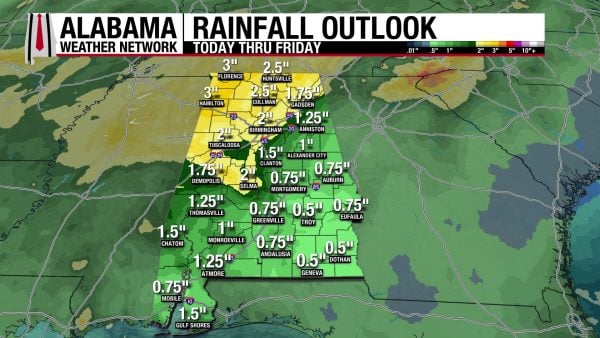
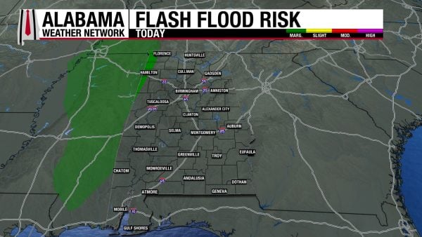
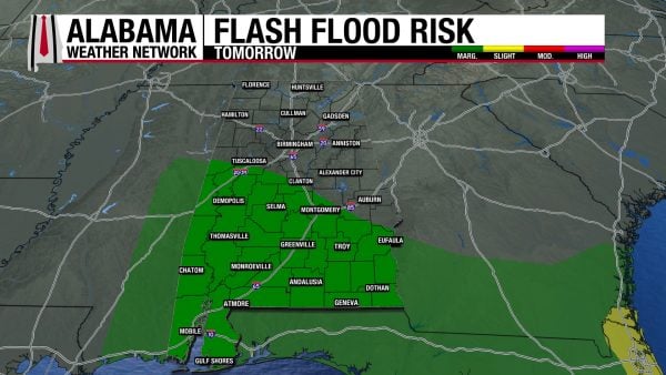
With our more active weather pattern we’re expecting this week, rainfall totals across the state will range from 0.5″ to 1.5″ in the south, 0.75″ to 2″ centrally, and 1″ to 3″ in the north. That larger 3″ total is expected in the northwest. The Weather Prediction Center has placed the northwest corner of the state under a Marginal Risk (1/4) of flash flooding today. The risk shifts to the southern half of the state tomorrow.
LITTLE CHANGE TO DROUGHT CONDITIONS
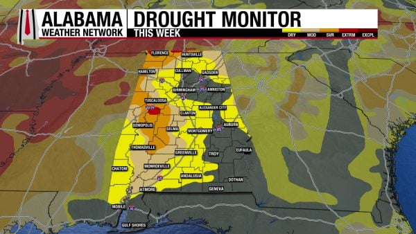
Over the past week, Alabama’s drought has worsened but only slightly. Severe Drought (D2) conditions have expanded to impact 13.22% of the state this week, increasing from 8.71% last week. Extreme Drought (D3) conditions have expanded from impacting 0.81% of the state to impacting 1.52% of Alabama. Luckily, the rain we’re expecting this week will target the northwest, where the drought is worst, but it will only make a dent in getting conditions back to normal.
FOOTBALL FORECAST
MAGIC CITY CLASSIC: ALABAMA STATE VS. ALABAMA A&M
Alabama State and Alabama A&M face off at 2:30 p.m. CDT at Legion Field in Birmingham today. Overcast skies with a risk of a passing shower are expected during the game. Temperatures will be in the mid 70s at kickoff and will fall to 70 degrees by the end.
AUBURN VS. OLE MISS
Auburn will play Ole Miss in Oxford at 11:45 a.m. CDT this morning. Mostly cloudy skies and a chance of showers are expected. Temperatures will be in the mid to upper 70s.
SOUTH ALABAMA VS. LOUISIANA TECH
South Alabama hosts Louisiana Tech this afternoon, with a 2:00 p.m. CDT kickoff. Expect mostly cloudy skies and a possible shower. Temperatures will start in the upper 70s and fall to the mid 70s by the end of the game.
THE ATLANTIC
There is no tropical activity in the Atlantic.
THE PACIFIC
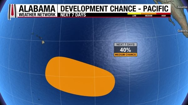
An area of low pressure is expected to form well southeast of the Hawaiian Islands early next week. It has a 40% chance of developing into a tropical system over the next 7 days.
WET BEACH WEEKEND AHEAD
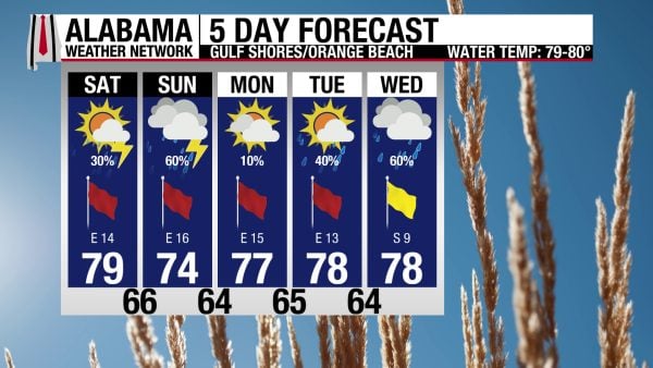
A low chance of showers and thunderstorms is expected on the coast today. Mostly cloudy skies, a high in the upper 70s, and east winds around 15 mph accompany the rain chance. These brisk easterly winds cause the rip current risk to be High today and the surf height to be around 3 to 4 feet. Tomorrow will see a higher chance of rain and a high in the mid 70s.
TODAY IN WEATHER HISTORY
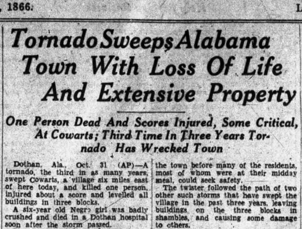
October 31, 1932 – Cowarts Tornado
On October 31, 1932, a deadly tornado swept through Cowarts, a small community in Houston County in southeastern Alabama, leaving a trail of destruction through homes, farms, and timberland. Around 11:30 a.m., the tornado touched down near the northern edge of town and began moving northeastward. Later assigned an F2 rating based on historical damage accounts, the storm carved a path approximately four miles long and reached a maximum width of 350 yards. Six homes were completely destroyed, and enormous trees were uprooted or snapped as the tornado tore across the countryside. By the time the storm dissipated, one person had been killed and 16 others injured. For a close-knit farming community already familiar with destructive tornadoes, the Halloween disaster brought another painful chapter in its history.
Among the victims was six-year-old Orie Mae Cochran, whose life was lost when the tornado destroyed a home along its path. The destruction was particularly devastating for families living in the rural areas surrounding Cowarts, where houses stood among fields, orchards, and extensive stands of timber. The tornado struck with enough force to demolish residences and scatter wreckage across the surrounding property. Survivors faced damaged homes, blocked roads, and the difficult task of locating injured neighbors. In 1932, there were no modern tornado warnings, Doppler radar, or television weather broadcasts to alert residents to an approaching circulation. For many families, the first indication of danger would have been the sudden roar of the wind and the destruction unfolding around them.
Beyond the residential damage, the tornado devastated an extraordinary amount of timberland. Historical reports estimated that approximately 400 acres of trees were flattened along its path, leaving broad stretches of woodland broken and exposed. The scale of the timber destruction was especially significant in a region where lumber production and agriculture had long supported the local economy. Fallen trees and scattered debris complicated travel through the affected countryside, while damaged homes and farms represented serious financial losses during the depths of the Great Depression. The National Weather Service’s historical database estimates property damage at $30,000, a substantial sum for a small Alabama community in 1932.
The October tornado was especially cruel because Cowarts had already suffered a destructive tornado earlier that same year. On February 21, 1932, an F3 tornado had passed near the community around 10 p.m., destroying several homes, injuring five people, and flattening additional acres of timber. One large residence was so badly damaged that only a single room remained intact. The community also carried memories of an earlier deadly tornado in January 1918 that devastated the area between Dothan, Cowarts, and Webb, including a rural school where a teacher and seven children were killed. For residents of Cowarts, the October disaster was another reminder of a danger that had returned repeatedly, striking both in the darkness of night and during the daylight hours.
The Halloween tornado of 1932 remains a significant event in the weather history of Alabama’s Wiregrass region. Although its four-mile path was relatively short, the destruction of six homes, the loss of hundreds of acres of timber, and the injuries to 16 residents demonstrated the concentrated power of a strong tornado. Its F2 rating was assigned retrospectively, since the Fujita Scale would not be developed until decades later. The disaster also occurred during one of Alabama’s deadliest tornado years, when the catastrophic March 21 outbreak had already claimed hundreds of lives across the state. For Cowarts the October 31 tornado was a tragedy measured in destroyed homes, injured neighbors, and the loss of a young child, leaving a lasting reminder of what violent weather is capable of.
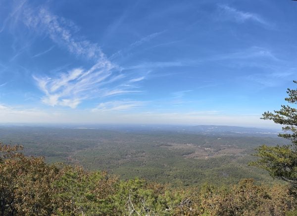
IMAGE OF THE DAY
Skywatcher Lucretia Wyatt sent in this serene photo from Mt. Cheaha yesterday afternoon!



