


Daily Weather Briefing
Sunday, November 8, 2026
ALABAMA THIS MORNING
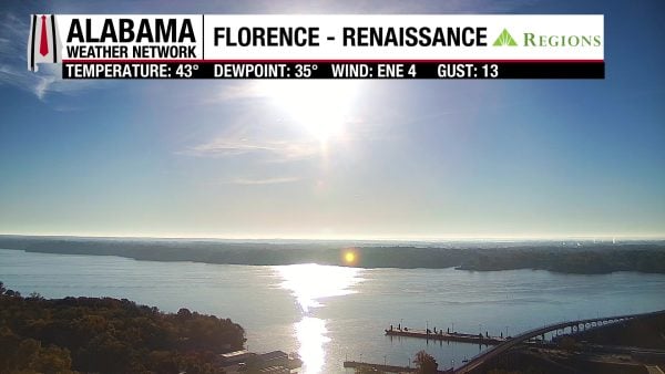
Temperatures are cold this morning and range from the upper 30s north to the low to mid 40s over the southern two-thirds of the state. Southeast and coastal Alabama sit in the upper 40s. A Frost Advisory for the northern two-thirds of the state expired recently. Our Regions Skycam in Florence-Renaissance is bright with the morning sun reflecting off the water!
ALABAMA 7 DAY FORECAST
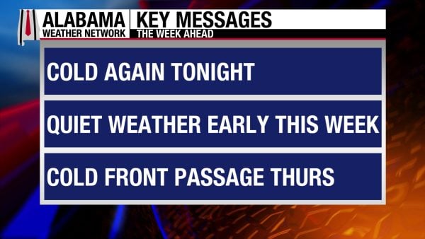
Cool, dry air sits across the Eastern U.S. thanks to a surface high-pressure system. This surface high pressure will persist throughout most of the week before a strong cold front moves through Alabama Thursday into Friday. Much colder, drier air will filter into the state, bringing a better chance of morning frost by next weekend, but not before a few showers shake out during the frontal passage.
COOL START TO THE WEEK – Nov 8-9
Today and tomorrow will be pleasant and rain-free.
Today will be mostly cloudy with highs in the mid 60s north, mid 60s to low 70s centrally, and low 70s south.
Monday morning will be quite cold again, with temperatures ranging from the mid 30s north and upper 30s and low 40s in central and south Alabama. The coast will hit the upper 40s. Another Frost Advisory may be warranted. Then as we head into the afternoon, temperatures will rise to the upper 60s north and low to mid 70s across the southern two-thirds of the state.
QUIET MIDWEEK – Nov 10-11
Tuesday and Wednesday will continue the quiet weather, although mornings won’t be as cold.
Tuesday’s morning temperatures will be in the upper 30s north, and low to mid 40s across the southern two-thirds of the state. Highs will reach the upper 60s to low 70s in the north, the low to mid 70s centrally, and the mid to upper 70s south.
Wednesday morning will be a lot warmer, with lows in the mid to upper 40s in the north and the low to mid 50s in central and south Alabama. Coastal Alabama will only hit the upper 50s. Despite the warmer lows, highs will hit the low to mid 70s, which is on par with highs from earlier in the week.
COLD FRONT PASSAGE THURSDAY – Nov 12
A strong cold front will pass through Alabama on Thursday, bringing a low chance of rain to the state. Alabama’s air will be very dry, so the atmosphere will have a difficult time squeezing out meaningful rainfall. Lows will spread from the mid 40s north to the mid 50s south, then highs will range from the low 60s north, mid to upper 60s centrally, and low 70s south.
COLDER FRIDAY AND SATURDAY – Nov 13-14
A Frost Advisory will most likely be necessary on Friday morning for the northern two-thirds of the state, as lows will drop into the mid 30s in the north and to the low to mid 40s south. Highs on Friday will be quite chilly and the coldest we’ve seen this season as they will be limited to the low to mid 50s north, mid to upper 50s centrally, and upper 50s to low 60s in the south.
Saturday morning will start off quite cold as well, and another frost advisory could be issued, with the low 30s possible in the north! Then temperatures will rise to the mid 50s north, upper 50s to low 60s in central Alabama, and the upper 50s to low 60s south.
RAINFALL OUTLOOK
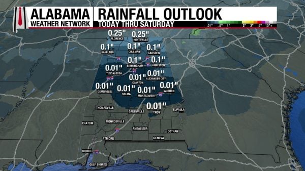
As previously mentioned, Thursday’s front won’t be much of a rainmaker, so the northern half of Alabama is only expected to see a hundredth of an inch to a quarter of an inch of rain this week, while the southern half will stay dry.
THE ATLANTIC
The Atlantic will not see any tropical activity over the next seven days.
THE PACIFIC
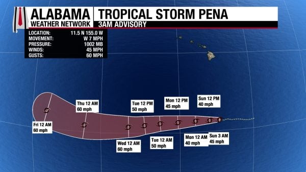
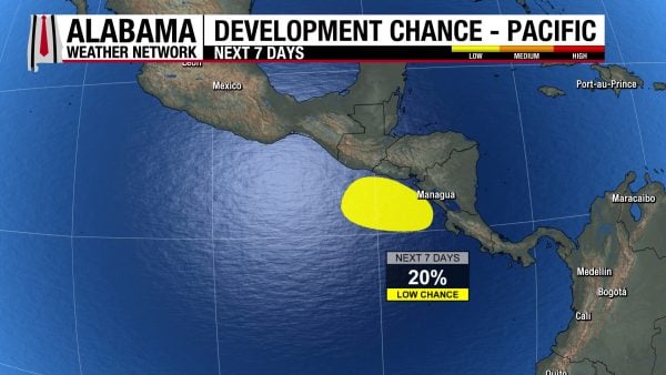
Tropical Storm Pena will continue west over the next several days but is not expected to strengthen above tropical storm strength.
The area of low pressure off the coast of Central America only has a 20% chance of developing into a tropical system now, but it will still bring heavy rain to the area this week.
AGREEABLE BEACH WEATHER CONTINUES
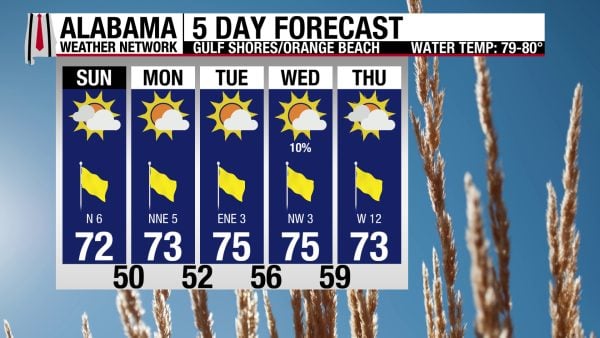
Alabama’s Gulf Coast has been beautiful, and pleasant conditions continue this week. Today’s high will be in the low 70s, skies will be sunny until noon, then partly sunny through the rest of the day. Winds will be from the north at 5 to 10 mph, and the rip current risk is Low, with a surf height of 1 foot or less. Very similar conditions are expected through Thursday.
WEATHERBRAINS 1086
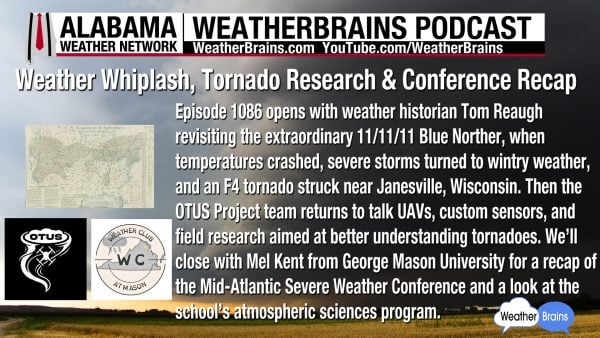
Tomorrow’s WeatherBrains episode is packed to the brim with interesting people and topics! Tom Reaugh will revisit the 11/11/11 Blue Norther, the OTUS Project team returns to talk about UAVs, custom sensors, and their research, and Mel Kent will recap George Mason University’s Mid-Atlantic Severe Weather Conference! So much to hear about, so listen to the episode wherever you get your podcasts or watch here!
TODAY IN WEATHER HISTORY
November 8, 1989 – Alabama and Georgia Tornadoes
On November 8, 1989, a powerful line of thunderstorms swept across Alabama and Georgia, producing damaging tornadoes, torrential rainfall, and widespread destruction during an unusually active period of autumn severe weather. A strong cold front advancing across the Southeast encountered warm, moisture-rich air flowing northward from the Gulf of Mexico, creating favorable conditions for rotating thunderstorms. Before sunrise, the storms reached Alabama’s Wiregrass region, where residents of Dothan were awakened by violent winds and heavy rain. At approximately 4:50 a.m. CST, an F1 tornado touched down along U.S. Highway 231 on the northeastern edge of the city. The tornado moved eastward through several residential and commercial blocks, carving a path approximately one mile long and 40 yards wide. Although relatively narrow, the circulation packed enough force to leave a remarkable trail of destruction.
The early-morning tornado destroyed two homes and caused significant damage to businesses and an office complex. Two commercial buildings sustained major damage, while another suffered moderate damage. Winds shattered the windows of approximately 50 automobiles, scattering broken glass across parking lots and streets. Hundreds of trees were snapped or uprooted throughout Dothan, leaving roads blocked and neighborhoods littered with branches and debris. Property losses were estimated between $500,000 and $750,000, a substantial amount for a brief tornado in 1989. Remarkably, no injuries were reported from the tornado itself. The timing made the event particularly dangerous, striking while many residents were still asleep and visibility was limited by darkness and heavy rainfall.
The severe weather continued through the morning as additional thunderstorms moved across southeastern Alabama. At approximately 9:50 a.m., a second, weaker F0 tornado touched down in Dothan, traveling about three-tenths of a mile. This tornado damaged the awning of a home, struck part of a church, and uprooted several trees before dissipating. Elsewhere in the Wiregrass, damaging thunderstorm winds brought down telephone lines near Samson in Geneva County, where a mobile home was blown into a pond and three people suffered minor injuries. Heavy rainfall also created dangerous flooding conditions. At Wallace Community College in Dothan, approximately 2,000 students were instructed to remain inside buildings as floodwaters spread across the campus. Vehicles were reportedly floating in the parking lot, illustrating how the day’s thunderstorms produced serious hazards even outside the relatively narrow tornado paths.
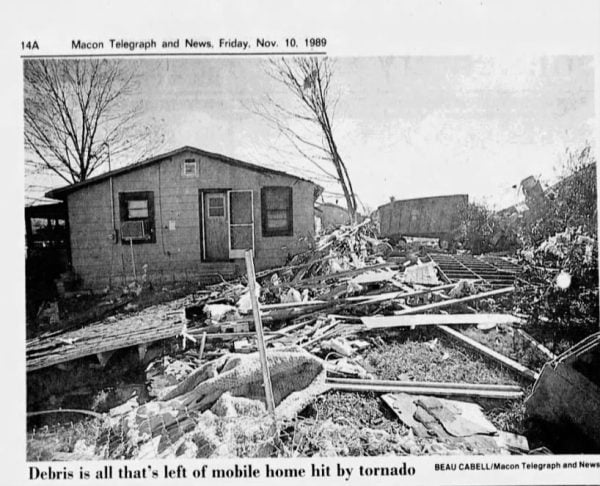
By late afternoon, the severe weather had reached central Georgia, where the day’s deadliest tornado struck the small community of Pineview in Wilcox County. At approximately 5:35 p.m. EST, an F2 tornado touched down and moved northeastward across a peanut field toward a residential neighborhood. The tornado damaged a peanut warehouse and pushed several heavily loaded peanut wagons, some weighing approximately a ton, hundreds of feet across the property. It then struck nearby homes and manufactured housing, destroying three mobile homes and damaging additional residences. One person was killed, and eight others were injured as the tornado tore through the community. The storm remained on the ground for approximately eight-tenths of a mile and reached a maximum width of 100 yards. Its concentrated destruction demonstrated how a relatively short-lived tornado could produce devastating consequences when it crossed a populated area.
The November 8 severe weather episode left a lasting mark on communities across southeastern Alabama and central Georgia. In Dothan, two tornadoes struck within five hours, damaging homes, businesses, vehicles, and trees, while flooding created additional emergencies across the city. In Pineview, the destruction was more tragic, with one fatality and eight injuries from a tornado that traveled less than a mile. The outbreak demonstrated the dangers of the Southeast’s secondary tornado season, when powerful autumn systems can produce severe thunderstorms despite the shorter days and cooler temperatures of November. The early-morning tornadoes in Alabama also underscored the vulnerability of sleeping residents, particularly before the widespread availability of modern Doppler radar and wireless emergency alerts.
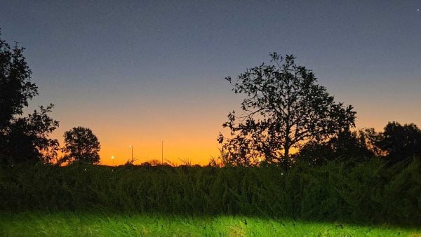
IMAGE OF THE DAY
Skywatcher Sandra Kirkwood captured the beginnings of the sunrise in Huntsville this morning.



