RADAR CHECK: Some scattered light rain is moving into South Alabama this morning… really nothing more than sprinkles. It will be gone by late morning, and the afternoon will be dry with temperatures rising into the 70s across the state.
A cold front will push a few showers across Tennessee tonight; a few might get down into extreme North Alabama, but again most places will stay dry. Then, tomorrow will be a breezy and cooler day with a high in the 60s and low 70s.
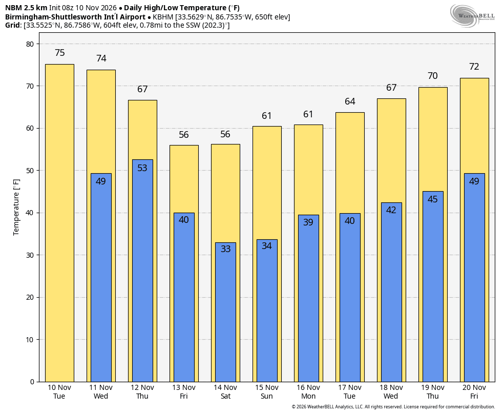
COLDER: The coldest air so far this season arrives Friday; highs will be in the 50s over the state with a very cool breeze. Temperatures will drop into the 28-35 degree range across most of the state by both Saturday and Sunday morning with a freeze for many communities across North Alabama. The weekend will feature a sun filled sky with highs between 53 and 60 Saturday, followed by upper 50s and low 60s Sunday.
NEXT WEEK: A disturbance will bring some light rain to Alabama Monday, mainly over the southern half of the state. Lingering light rain will end across Southeast Alabama Tuesday, and the rest of the week looks dry with a warming trend. Temperatures will be close to 70 by the end of the week… See the video briefing for maps, graphics, and more details.

TROPICS: The Atlantic basin remains quiet and tropical storm formation is not expected through at least the next seven days.
FOOTBALL WEATHER: Saturday Auburn will travel to Starkville to play Mississippi State (11:00a CT kickoff). Expect a sunny sky with temperatures rising from near 48 degrees at kickoff into the mid 50s by the end of the game.
Alabama will be in Nashville to take on Vanderbilt (11:45a CT kickoff). The sky will be sunny; temperatures will rise from near 47 at kickoff into the low 50s by the final whistle.
The weather will be cool and dry for all of the other games across the Deep South.
ON THIS DATE IN 1911: A powerful cold front, known as the Great Blue Norther of 1911, produced some of the most extreme temperature changes to the Nation’s midsection. Ahead of the cold front, a warm and moist environment caused a severe weather outbreak with several strong tornadoes reported in Iowa, Illinois, Indiana, Wisconsin, and Michigan. An estimated F4 tornado occurred from Janesville to Milton, Wisconsin, and caused extensive damage to several farms and killed nine people. The citizens of Janesville, Wisconsin, reported blizzard conditions with a temperature near zero within an hour of the tornado.
Look for the next video briefing here by 3:00 this afternoon… enjoy the day!