


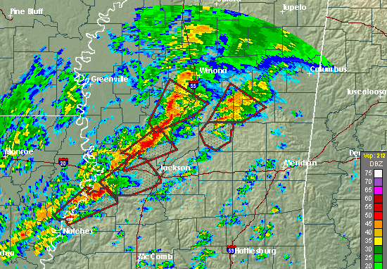
Numerous tornado warnings are in effect across Mississippi, and there have been reports of at least 2 tornadoes, one doing structural damage near Yazoo City, MS.
The wind shear is extremely high across MS and AL tonight, with strong warm air advection in place. The UAH MIPS wind profiler shows winds at 3,000 feet around 60 mph, and the winds veer from SE at the surface to SW above 5,000 ft. This rapid change in wind direction and speed with height is causing very high helicity values tonight…over 500 m2/s2 across much of AL/MS. However, despite dewpoints in the 60s pushing northward, the air is not very unstable, with positive CAPE values generally confined to areas south of a line from MGM to Meridian, MS.
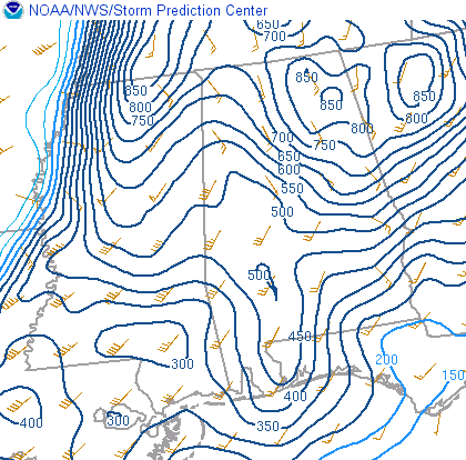
Storm relative helicity values
This sets up the classic cold-season severe weather situation, with powerful wind shear but limited warm, unstable air. Interestingly, wind shear in and of itself has been shown to support thunderstorm updrafts even when instability is very weak, as long as there is at least some instability. This is shown by the severe storms in central MS where the air is fairly stable.
The concern from SPC tonight is due to the extreme wind shear causing any storms that do form to rotate. Also, with the very strong winds just above the surface, any storm downdraft can bring those winds to the surface, downing trees and power lines.
Have a plan in place for what you will do if a tornado warning is issued for your area tonight. Leave your NOAA Weather Radio on alert mode. The storms are a little ahead of schedule, and could affect parts of west Alabama by midnight. The main threat in BHM is still between midnight and 9 am.
Expect a tornado watch in parts of Alabama by midnight or so.



