


Rain is increasing over the western half of Alabama tonight. It has been raining for a few hours over Northwestern Alabama, and one to two inches of rain has already fallen.
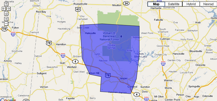
The NWS has issued a flood advisory for parts of Marion, Walker and Winston Counties. Additional heavy rain is falling over these counties.
Further south, heavy showers and developing to the southwest of the Birmingham Metro area and will be moving over the city over the next couple of hours.
The cold front over western Mississippi is moving slowly eastward. Heavy rain and thunderstorms will continue to develop ahead of it overnight and on Saturday.
From NESDIS: Here is graphic that shows where the heaviest rainfall should setup over the next few hours…
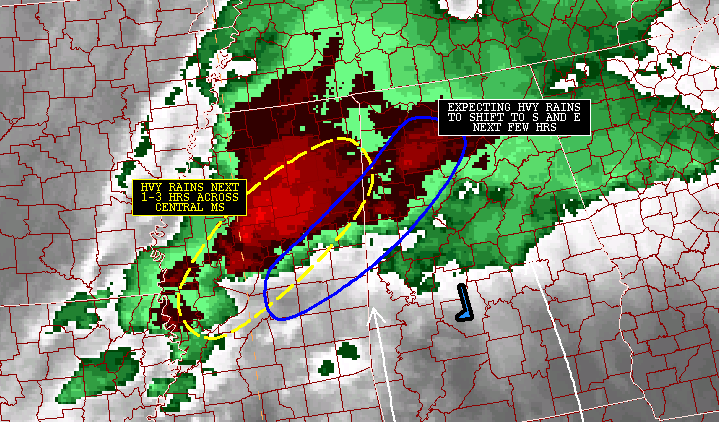
Areas from Pickens and Lamar Counties northeastward into Fayette, Walker, Winston and Morgan Counties will be affected.
Numerous flash flood warnings are in effect over Mississippi.
There is still quite a bit of instability over South Central and southern Mississippi. A special 10 p.m. balloon launch from Jackson revealed there is over 1500 j/kg of instability and over 500 m2/s2 of helicity. The cap is totally absent.
A really dangerous looking storm just passed through Yazoo City MS. Can they catch a break? It is now northeast of the city and is tornado warned. Officials are checking for damage.
If instability levels increase over western Alabama, the severe weather threat will continue to shift into West Central sections of the state, where the tornado watch is in effect.
Stay alert and close to a source of weather information through the night.



