


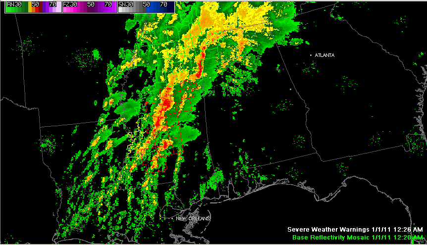
Strong storms are moving into West Alabama’s Franklin, Marion and Lamar Counties. They are accompanied by torrential rains and very intense lightning.
They are not severe at this time but do show signs of bowing out into a damaging wind event over Marion and northern Lamar Counties. Instabilities are negligible over Alabama at this time, but low level helicities are maxed out over Northwest Alabama. That means any stronger updrafts that do manage to form could become severe and could even produce an isolated tornado.
We will continue to watch them.
Dangerous storms further back into Mississippi from south of Pontotoc to Kosciusko to west of Canton to east of Natchez are packing a little more punch with several tornado warnings in effect. There is an isolated discrete cell in front of the main line southwest of Forest It is an especially rough looking storm.
A tornado watch remains in effect until 6 a.m. for West Central Alabama and a flash flood watch until noon for all of North and Central Alabama. Wind advisories have been issued for areas across Central Alabama through 9 a.m. for wind gusts to



