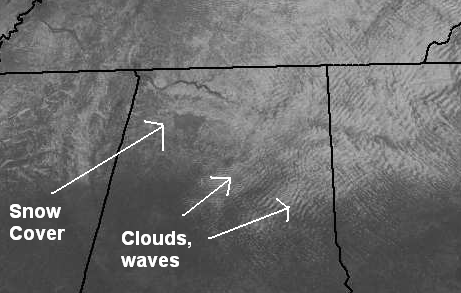
The visible satellite picture is neat today. It shows the snow cover from about BHM north (notice the Tennessee River). It also shows clouds over central and east Alabama, likely associated with small gravity waves, caused by air blowing from the NW over the terrain around here (Red, Shades, Double Oak Mountain, etc.). In these little wave clouds, there have been some snow flurries.
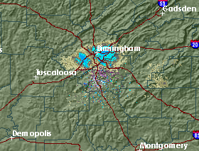
As Jason points out in the blog below, the snow flurries have been mainly “under the radar”. For one thing, the snow flakes are small, and for another, they are falling from only about 3,000 ft. above the ground (or lower). They are like summer showers, in that it took the sun coming out and heating the ground a little to get them going. Since there is so much dry air above 3,000 ft., and the radar beam rises as it gets away from the radar (earth curves out from under it mainly), the radar can only see the snow really close to it. This radar picture is from 1115 am, when the snow was a little heavier.