


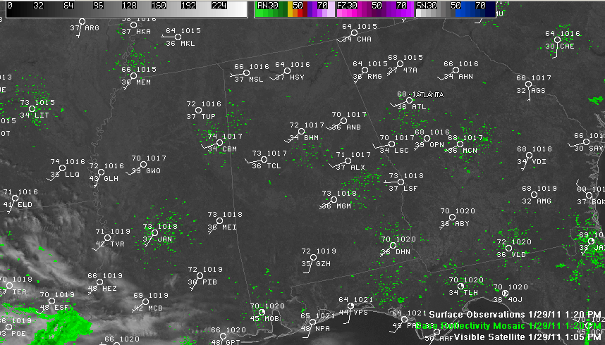
Temperatures have soared under totally clear skies across Alabama today, rising to 70 at Birmingham at 1 p.m. Readings will top out in the lower 70s across Central Alabama. The nearest cloudiness is high clouds over eastern Texas and much of Louisiana associated with an approaching disturbance over the southwestern U.S. and increasing moisture on the back side of a high pressure system that is sitting over the eastern Gulf of Mexico. Some of these high clouds will overspread the state tonight. Temperatures will fall back into the lower 40s.
FOR YOUR SUNDAY: Can’t promise 70s tomorrow, with increased cloudiness across the area. You should see at least some sun for much of the day, and highs will top out in the middle to upper 60s. Showers associated with that disturbance should reach western sections of the state by afternoon and will overspread the state during the evening. Rainfall amounts overnight should be less than a quarter of an inch, with some slightly higher amounts over South Central Alabama.
START TO A NEW WORK WEEK: It looks like Monday will be cloudy and relatively mild, at least by recent standards, with highs in the lower 60s. There will be a chance of a shower during the day as a southeasterly flow increases ahead of our next major storm system.
SEVERE WEATHER TUESDAY NIGHT? Too early to be definite, but signs are there that we could have a very active weather Tuesday night as a strengthening low pressure system swings out of Louisiana and into western Tennessee We could see strong to severe thunderstorms Tuesday evening into the overnight hours. The question as it often is with these early season systems is how much instability will there be. It does appear that there will be fairly strong dynamics. Stay tuned.
HEAVY RAIN ALSO LOOKS LIKELY: One to two inches of rain is likely across Alabama in the week ahead, with the bulk of it falling Tuesday night into early Wednesday.



