


Click to view full size image
Temperatures have risen into the 70s across Central Alabama early this afternoon.
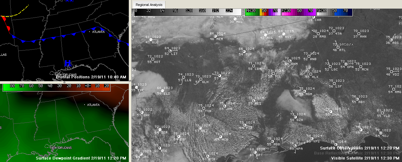
As the top left panel in the SimuAwips image above indicates, a weak cold front stretches across North Central Alabama. The large panel shows visible satellite imagery and surface observations. Clouds behind the front have kept readings in the Tennessee Valley in the 60s.
In the bottom left panel, you can see drier air that has infiltrated the Tennessee Valley, where dew points are in the 40s. To the south, dew point readings in the 50s are common. Skies are mostly clear over East Central Alabama around Anniston. There is still a patch of low clouds over South Central Alabama between Montgomery and Greenville. Cumulus clouds have popped up over much of Mississippi, Southwest Alabama and Northwest Florida. Notice that the clouds are only over land. Over the cooler water of the Gulf, skies remain clear. Convection at work!
Radars are clear, but I guess we can’t rule out a shower this afternoon or tonight somewhere across the area. Chances are very small.
Tomorrow will be a couple of degrees warmer than today. We will be flirting with Perfect Weather Warning conditions tomorrow, so prepare now!



