


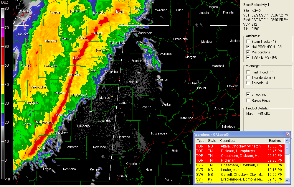
Click image to expand
FROM THE NWS JACKSON
…numerous trees and powerlines down in Yazoo City…trees across roads…numerous power outages.
…numerous trees down around Carrollton in Carroll County…that is just west of I-55, or east of Greenwood.
…several trees down in numerous locations around Grenada…59 mph gust at Grenada Airport
…roof blown off of restaurant in Cleveland
…power outages in Greenwood…56 mph gust reported at GWO
All of this activity is about an hour away from Franklin, Marion and Lamar Counties and should arrive between 10-10:30 p.m. .
The southern part of the activity is about an hour and a half from Lamar and Pickens Counties…it should arrive between 10:15 and 10:45 p.m.
There are very strong winds aloft only a short distance above the ground and these thunderstorms will be able to tap that fast flow to cause widespread damaging winds gusting to 70 mph or higher. There will also be numerous 30-40 mph wind gusts even outside of storms.
Please pay attention to the latest severe thunderstorm warnings tonight and be in a safe place when these dangerous storms approach. We could even deal with a few isolated tornado reports. The NWS Jackson just had a tornado vortex signature pop up near Durant and they have issued a tornado warning



