


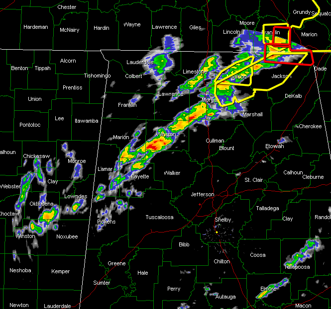
Thunderstorms continue to slowly intensify over Northwest and North Alabama this afternoon.
Several severe thunderstorm warnings are in effect from Morgan and Madison Counties up into Jackson County. There is even a tornado warning for northern Jackson County. The Madison County Sheriff’s Department reporting structural damage to several barns, sheds and homes along Borderline Road just south of the Tennessee Line. Assessing extent now.
Storms have grown pretty intense over southwestern Winston County around Lynn and Double Springs. Another storm is trying to get organized between Addison in Winston County and Falkville in Morgan County. This storm will likely become severe as it moves northeast.
Additional cells are lined up back into eastern Mississippi near Columbus, Starkville and Louisville. These storms will have the potential to become severe as they move northeast into air that is fairly unstable (500-1000 j/kg2 CAPEs) and shows decent wind shear. The 850 mb jet is still located over Northwest Alabama. The best chance for tornadoes may be east of this jet as it rotates slowly northeastward.
Low level helicity values are still above 350 m2/s2 from Bibb and Tuscaloosa Counties up through Jefferson, Walker and on into the Tennessee Valley.
Continue to pay close attention to the latest weather information throughout the afternoon.



