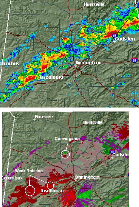
The line of storms, just ahead of the cold front, now extends from near Gadsden to Sumiton to Northport. It will be moving into TCL within the next 15-30 minutes, and the BHM metro between 3 and 4 pm.
Despite strong low-level winds, the low pressure area is a long way from here, and there is not much change in wind direction with height, especially south of Cullman. This may explain the lack of any tornadoes so far. The air is still very unstable, and the upper-level system is approaching, so storms may continue to intensify over the next hour. I wouldn’t be surprised if severe thunderstorm warnings were issued for some counties farther south (Jefferson, Walker, Tuscaloosa, Blount, and/or Etowah) soon. But, so far so good on tornadoes here in central Alabama. We could still see a spin up (the storms are weakly rotating now, and maybe a tornado, but the main threat will be damaging straight line winds.