


Click this image to expand.
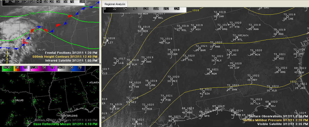
These three weather graphics tell the story on this beautiful March Saturday afternoon.
Temperatures (shown on the right side panel) are in the lower 70s. Dewpoints are in the 30s, making it feel crisp. Winds are beginning to shift around to the south. You can see moisture in the form of streets of cumulus clouds over Louisiana in the southerly flow on the visible satellite image on that same panel.
The upper left panel shows clouds over Texas and Oklahoma spreading into Arkansas and Louisiana. This activity is in association with the upper level disturbance shown in the flow at 18,000 feet above the ground (see that little kink in the green line) and an associated weak surface low. All of those blue pennants and red half circles signify a wavy stationary front that cant really come much further south thanks to high pressure at the surface over Florida. On the right panel, you can see a ridge extending up into Alabama from the high to the south.
In the lower left panel, you see ground returns from regional radar sites. The nearest precipitation to Alabama is way off this image over Missouri and Central Illinois.
We will those high clouds to the west start streaming across overnight. Lows will drop into the middle 40s with a few colder spots possibly getting to 40F or just below.
Tomorrow will feature more clouds, but still a decent supply of sunshine. Highs will be in the lower 70s. It looks like any shower chances will hold off until Monday morning at the earliest now. The best chances will come Monday night. There could be a couple of thunderstorms involved Monday night, but they won’t be strong or widespread it appears.



