


We have had a few hours of sunshine this morning, but more clouds are set to move in soon from Mississippi. An upper-air low centered over western Kentucky is flanked to the southwest by an expansive deck of low clouds over eastern Arkansas, Tennessee, and northern Mississippi. As the low moves east and temperatures at the surface warm toward the mid-50s over the next few hours, more clouds will fill in over Alabama. Here’s the satellite image from 10:00 AM showing the “donut” hole in the clouds over Central Alabama:
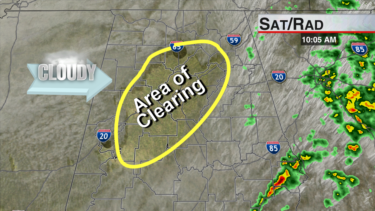
Satellite & Radar at 10 AM
Surface temperatures on the rise and cool air moving in about 3,000 to 5,000 feet above the ground will create a small amount of instability; it will not be enough for thunderstorms, but a field of cumulus clouds will start growing taller and wider through the middle of the day. A few isolated sprinkles can occasionally form in situations like this, but the chance of any one spot getting wet is less than five percent.
Scroll down for JB’s post about rainfall totals from last night & this morning! Add yours (and if you can, put your March total on there as well)!
-Jason
Follow me on Twitter: @simpson3340



