


NOTE AT 729 PM
Rotation is increasing with the storm that is just south of AL-118 between Winfield and Carbon Hill. A tornado warning is imminent.
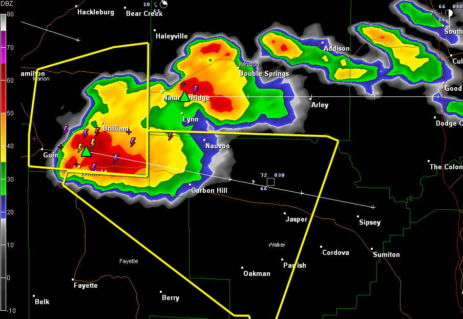
In West Alabama, the Marion County tornado warning has been changed into a severe thunderstorm warning. The storm is between Brilliant and Winfield.
The storm is turning to the right, so the Weather Service has issued a severe thunderstorm warning for Fayette and Walker Counties. It will travel down AL-118 toward Eldridge and Carbon Hill.
The storm just north of this one is intensifying. It is between Natural Bridge and Lynn. It could become severe.
There are storms lined up over northern Mississippi like planes landing at the Atlanta Airport. They are training along the boundary. Two surface lows are evident on the charts, one back near Texarkana, another over northern Mississippi. This will keep this boundary active for several more hours. All of this activity will affect the northern third of Alabama through the night as the lows ripple along the frontal system. It could be a long night.
Additional weather watches will be necessary this evening over Alabama.



