


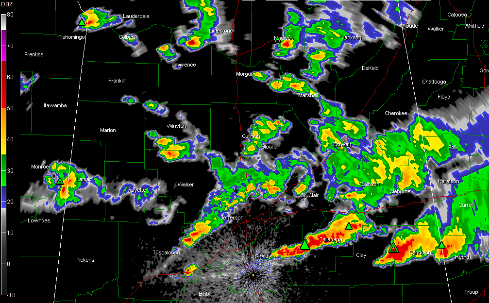
The boundary is sinking slowly southward tonight as the main low slinks eastward. The low is east of Tuscaloosa at this hour. The instability feeding into the boundary is relaxing as we lose the heating of the day and the airmass south of the boundary stabilize just a bit.
There are no warnings at this hour. There is a line of strong storms from Chelsea to Vincent to Talladega. Another strong storm extends from near Ashland to Lineville to Roanoke.
The Tornado Watch is canceled for Blount, Calhoun, Cherokee, Cleburne, Etowah, Fayette, Jefferson, Lamar, Marion, St. Clair, Tuscaloosa, Walker and Winston Counties.
Tornado Watch continues for Bibb, Chambers, Chilton, Clay, Coosa, Lee, Randolph, Shelby, Talladega, and Tallapoosa Counties till Mar 27, 3:00 AM CDT.
All of the activity should continue pushing southward through the early morning hours, ending up south of I-59 by sunrise. There could be a few showers during the morning, but skies should clear. Highs on Sunday will be in the middle 60s.



