


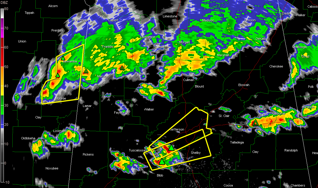
Click for larger image.
Thunderstorms continue across northern Mississippi and northern Alabama tonight.
Two severe thunderstorm warnings are in effect for the Birmingham metro from northern Bibb and eastern Tuscaloosa through Jefferson and Shelby Counties.
Severe thunderstorms are about to enter Northwest Alabama’s northern Lamar and Marion Counties from Mississippi.
There are heavy storms in the Anniston, Oxford and Heflin areas of east Alabama.
Other storms are over southern Morgan and much of Cullman County.
A strong cell just passed into Winston County from Marion County where skywatcher Melissa Wilson reported just after 1 a.m. that it was “pouring rain and hailing. not sure about size, lightning too much to go outside…”
Large hail is the threat from the severe storms. Hail to one inch is likely with the storm over Bessemer now that will cross much of the City of Birmingham.
Movement is northeast at 45 mph.
The back end of tonight’s activity is now about 100 air miles west of Lamar and Pickens counties and 160 miles west of Birmingham. At the current rate of speed, it should reach Lamar/Pickens about 4 a.m. and the Birmingham area by 5:30…Anniston by 7.



