


Some severe weather reports from Mississippi and Tennessee, courtesy of the NWS Jackson and the NWS Memphis.
This graphic shows reports received by the NWS Memphis through noon…
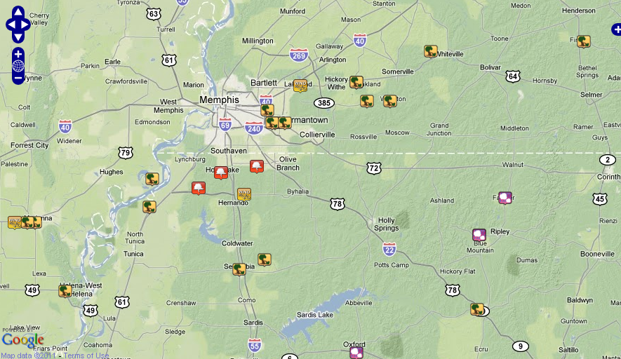
Click to expand
Other reports…
…multiple trees down in Senatobia in Tate Co MS at noon.
…two homes damaged by falling trees near Finger in McNairy Co TN at 1 p.m.
…Trees down…structural damage in the town of Parsons in Decatur County TN.
…Multiple trees down in Somerville in Fayette Co TN at 12:15.
…Roof blown off barn near Laconia in Fayette Co TN. at 12:20.
…Numerous trees down in the Henderson area of Chester Co TN at 12:49.
…Tornado reported on the ground on Mississippi highway 25 near the Tenn/Tom Waterway in Tishomingo County MS at 1:45 p.m.
…NWS Jackson reports…
…Several trees down across roads near Indianola in Sunflower Co MS. at 12:30 and a tree down on a car in Indianola.
…Steeple blown down off church in Cleveland at 12:25 p.m.
LATE REPORT
from Christopher Heater (via spotternetwork.org) @ 01:32 PM CDT — (S) Funnel — — Event is 2 miles NE of Counce, TN (Hardin county) [35.057/-88.246]– Rain wrapped funnel cloud near the dam (Pickwick Landing Dam). Could not tell if it touched down. (SN#7868). This is about 4 miles northwest of the Alabama border in Tennessee.



