


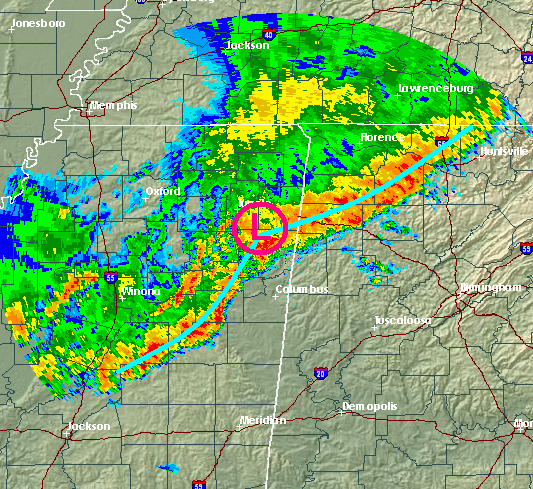
Things are becoming more complicated, as a small area of low pressure may be trying to form along the line of storms in northern MS. This may cause surface winds to blow into the low (more out of the SE than SW), as shown below.
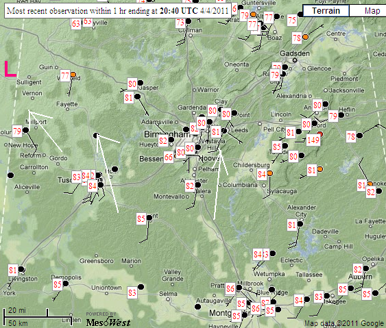
When the winds at the surface back out of the SE, it increases wind shear and helicity for storm rotation. So far, no storms are forming out ahead of the line, perhaps due to the small cap still in place (see Bill’s post from earlier). However, with temperatures in the 80s and dewpoints near 65, the air is getting very unstable over west-central Alabama, and any storms that form there may become severe. The overall line has slowed down now south of Cullman, and may not reach BHM until after 5 pm.
With the increasing helicity and instability, the energy-helicity index, a mesaure of tornado potential, is near 4 in west Alabama, fairly high.
This is a rapidly developing weather situation, and these mesoscale features are nearly impossible to forecast. Stay close to a source of weather information. Tornadoes are still possible, especially in the area from Pickens and Lamar Counties, over to Jefferson and Shelby counties. Either way, high winds and rain will move in this evening, possibly downing trees.



