


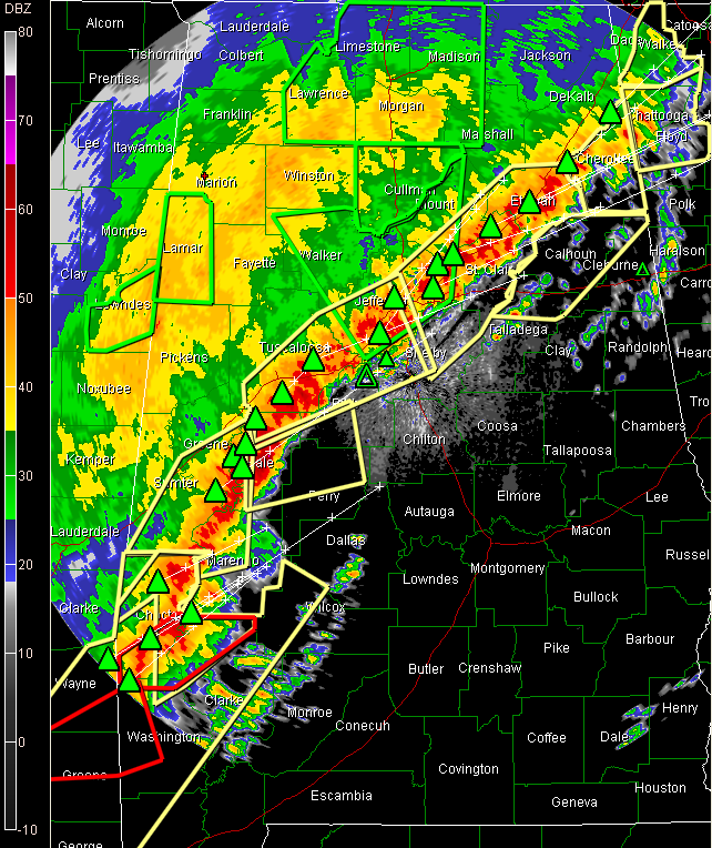
Here’s the latest at 7:50…
A line of intense thunderstorms continues moving southeastward at 25 mph tonight. It extends generally along I-59 from Fort Payne to Tuscaloosa, then southwestward through Greene and Sumter Counties.
Severe thunderstorm warnings cover the area from southern DeKalb and northern Cherokee through Etowah, Blount, St. Clair, Jefferson, Shelby, Bibb, Tuscaloosa, Greene, Hale, Sumter and Marengo Counties. New counties just added include: Calhoun, CLeburne, Talladega, Hale and Perry.
Numerous reports of wind damage as this line passes. Some late reports:
…tree down on house in Oneonta at 7:28pm
…3 inches of rain at Millport in Lamar County
…a few roads closed in southern Lamar County due to high water
…some power outages in Trussville
..tree down on County road 42 in Sumter COunty 6 miles SE of York
…tree down in Livingston
The main tornado threat appears to be shifting southward to the area from Choctaw and Marengo Counties up into the Montgomery area.
A nasty thunderstorm is in Choctaw County, south of Butler. VIL is approaching the top of the scale and tops are at nearly 50,000 feet.
It will pass near Sweetwater and Thomaston, passing north of Thomasville.
TORNADO WATCH canceled for Fayette, Lamar, Pickens, Walker and Winston Counties. It continues for areas southeast of there until 11 p.m.



