


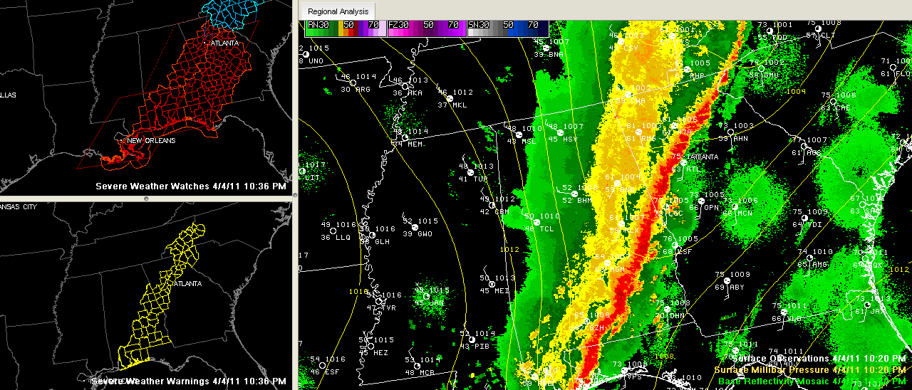
Click to enlarge
The back edge of the rain area now extends from Guntersville to Birmingham to Grove Hill. It is progressing eastward at about 30 mph.
That is just behind the cold front, which is progressing eastward across the state tonight.
Winds are averaging 24 mph out of the NW at Birmingham, gusting to 32 mph.
Temperatures have already fallen into the 40s over North Mississippi and North Alabama.
Birmingham was able to pick up 1.45 inches of rain tonight. We will take it. We were almost exactly even with the year to date average in the rainfall department before this rain arrived.
There are still flash flood warnings in effect for Cullman, Blount, Walker and Jefferson Counties, as well as Lamar County in West Alabama.
There are no severe thunderstorm warnings now in the Birmingham broadcast market area. Severe thunderstorm warnings do continue for Chambers, Tallapoosa, Macon and Montgomery Counties, and points south and southeast.



