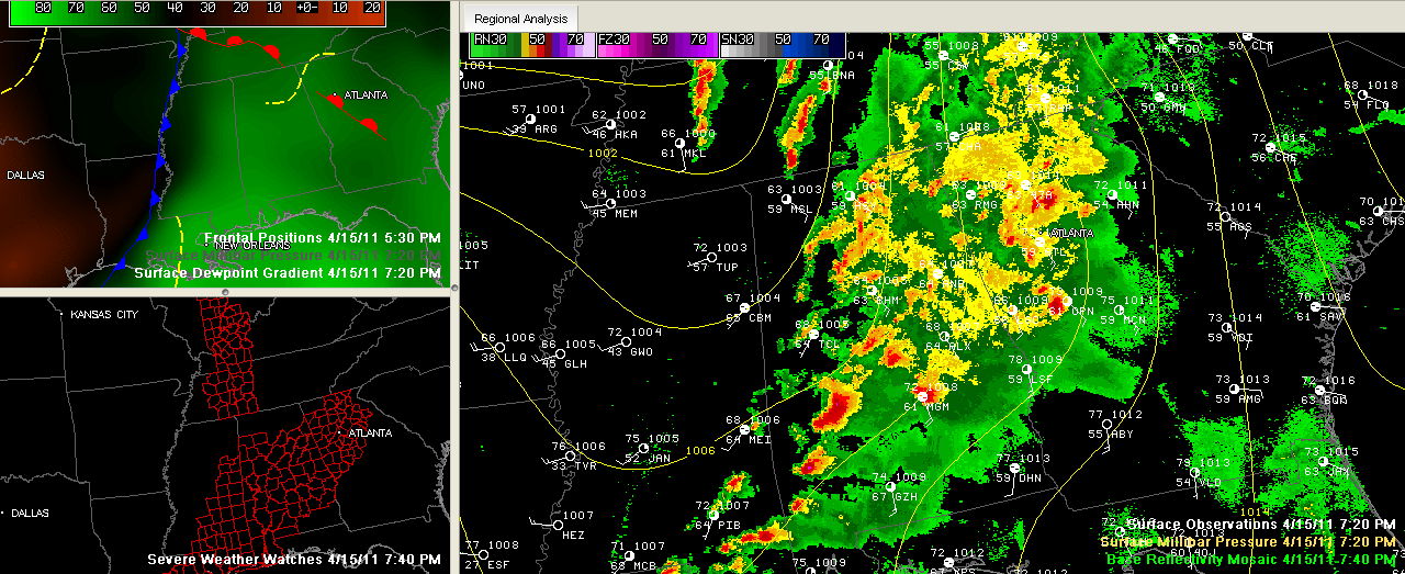
Our SimAWIPS graphic shows the current situation across Alabama and the South tonight.
You can see the trough in the yellow isobars. The storms are pushing east ahead of the trough.
Notice that the storms are east of a line from Muscle Shoals to Meridian. The back edge of the storm activity will reach I-65 in Central Alabama about 9:30 or 10 p.m. It will be out of East Alabama around midnight.
Also notice the cold front near the Mississippi River. Also the dewpoint gradient showing the drier air that is pushing quickly across the Magnolia State. The dewpoint has dropped to 43F at Greenwood in the Delta.
The bottom left panel shows the tornado watches. A big tornado watch still covers Central and South Alabama until 3 a.m. It runs generally from Tuscaloosa across Birmingham and over to Anniston and points south.
Skies will clear overnight, which could allow for some fog to develop later. Lows will drop into the upper 40s in Northwest Alabama, with lower 50s in Central Alabama. Then we will see some wraparound stratocumulus clouds down to I-20 tomorrow. Highs on Saturday will average around 70F with a breezy west wind averaging 15-20 mph.
We will be back in the 40s tomorrow night with a few 30s in colder spots across North Alabama.