


…SEVERE THUNDERSTORM WARNINGS FOR FAYETTE…LAMAR…MARION…PICKENS…WINSTON COUNTIES…SEE BELOW FOR DETAILS
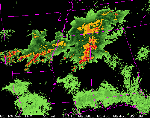
Thunderstorms are numerous from NW Alabama all the way to Arkansas. A front extends from Louisiana across central MS and central AL, and warm air advection and frontogenesis processes are helping storms to form mainly north of the surface front. These storms are elevated, meaning the updrafts are not rooted at the surface (like they are in big severe weather outbreaks), but are instead rooted 5,000 feet off the ground or so. In areas north of I-22/US-78, expect thunderstorms overnight with heavy rain, gusty winds, maybe some hail, and vivid lightning. Flooding could be a problem in some places.
Right along the front, there is extra wind shear, so storms farther south (from around Columbus, MS to Pelham to Sylacauga) have a chance to rotate, and we could even see an isolated tornado. No big outbreak, but have the weather radio handy. Also south of US-78, storms will be more scattered, but the ones that do form are more likely to be severe.
So, especially if you live in Tuscaloosa, Fayette, southern suburbs of BHM, Sylacauga south, keep checking the blog and have the NOAA Weather Radio on standby tonight.



