


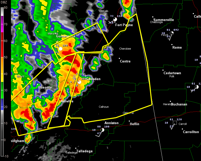
A severe thunderstorm warning continues for Calhoun, Cherokee, Cleburne, Etowah and St. Clair until 12:45 p.m.
Severe thunderstorms producing damaging winds of 60 mph extend from Albertville and Boaz to just west of Gadsden to Ashville to east of Birmingham.
They will affect areas included in the warning all the way to the Georgia border over the next hour.
DeKalb County also is under warning.
Dime sized hail and 60 mph wind gusts were reported in far northwestern Etowah County about 3 miles northwest of Aurora. Trees were blown down.
Power outages were reported in the Douglas area of Blount County.
Just in, a large tree was blown on to a house at Gadsden on Pearl Street…possible injury.
Just behind this, a Severe Thunderstorm Warning continues for Blount, Etowah, Jefferson, St. Clair [AL] till 12:15 PM CDT. Strong storms from west of Springville to the Leeds and Moody area produced wind damage earlier over western Jefferson County.
A severe thunderstorm watch has been issued for areas ahead of this activity…from northeastern Alabama into northern Georgia, eastern Tennessee, western North Carolina,, NW South Carolina and even Virginia and Kentucky. We will have the counties shortly but I would guess St. Clair, Etowah, DeKalb, Cherokee, Calhoun and Cleburne.
More strong to severe storms are possible through the afternoon across much of Alabama. A strong line of storms will move through tonight as well, with the potential for damaging winds and hail.



