


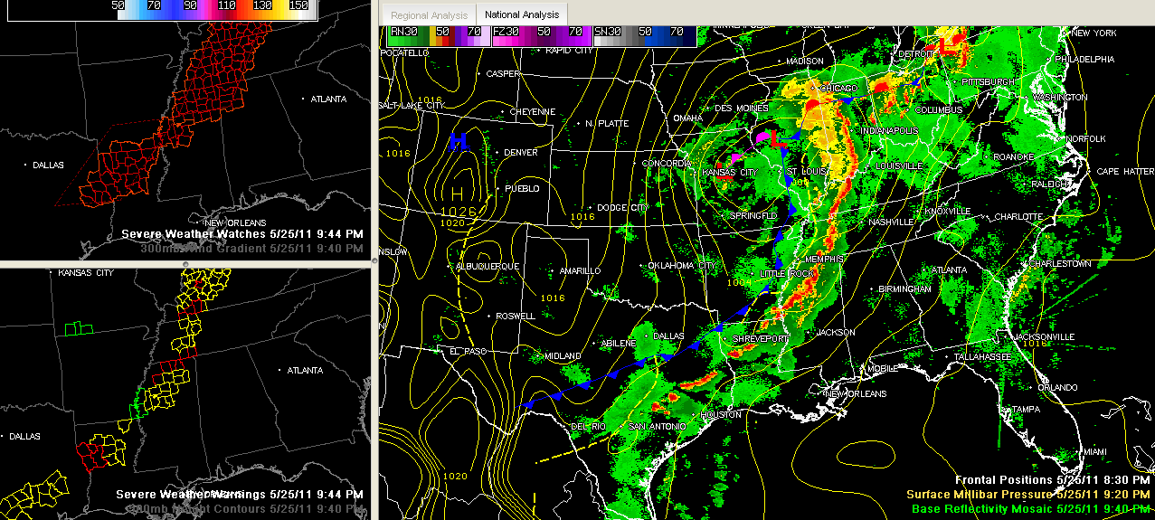
Strong storms continue tonight along a several hundred mile front from Chicago to west of Indianapolis to west of Nashville to east of Memphis to just northwest of Alexandria, LA. The line breaks up a bit the further west you go…but they reach all the way to near San Antonio.
A big upper low is rotating into Missouri. A surface low is located between Kansas City and St. Louis. Bothh lows are beginning to weaken and are running out of steam. A cold front curves back into Texas. The storms are ahead of the cold front that is pushing to the east.
The fact that the system is weakening gives us high confidence that we won’t see the type of severe weather that we have seen over the Midwest and Midsouth over the past four days, and certainly nothing like what we saw four weeks ago today.
Still, the storms will have the potential to produce damaging winds and ail as they push into West Alabama after 11 p.m. There is a low potential for a tornado or two over the Northwest part of the state, including Marion, Winston, Colbert, Franklin, Lauderdale, Limestone and Lawrence Counties, where a tornado watch is in effect until 4 a.m.
The strongest storms at this hour are near Oxford, south of Batesville and along US-82 between Greenville and Greenwood back in Mississippi. These storms have been showing a slow weakening trend over the past couple of hours, but are still packing a punch, and there are four tornado warnings and four severe thunderstorm warnings in Mississippi. We are still seeing scattered reports of wind damage from the Mississippi Delta of Northwest Mississippi.
The storms are moving east at 25 mph. They have been slowing in their forward progress over the past couple of hours as well as their upper level support weakens. They will reach the Northwest Corner of the state just after 11 p.m. They will push into Marion and Winston Counties just after midnight.
The storms will continue to push east overnight, reaching I-65 around 3 a.m. The storms will be weaker the further south that you go. They should be strongest north of a line from Hamilton to Cullman. By 6 a.m., the storms should be exiting Northeast Alabama.
Dr. Tim will be along with some mesoanalysis in a little while, so stay tuned for that. We will be monitoring the storms throughout the night and will talk you through it with a full staff overnight.
More storms will form over eastern Mississippi by midmorning and will push into western Alabama during the late morning hours. The storms will increase in coverage and intensity as the day wears on, with some heating from the sun, and could be severe. The biggest concentration of strong to severe storms will likely be east of I-65 during the afternoon. The biggest threat will e large hail, and some damaging winds. The tornado threat will diminish as the strongest low level wind shear departs to the northeast.



