


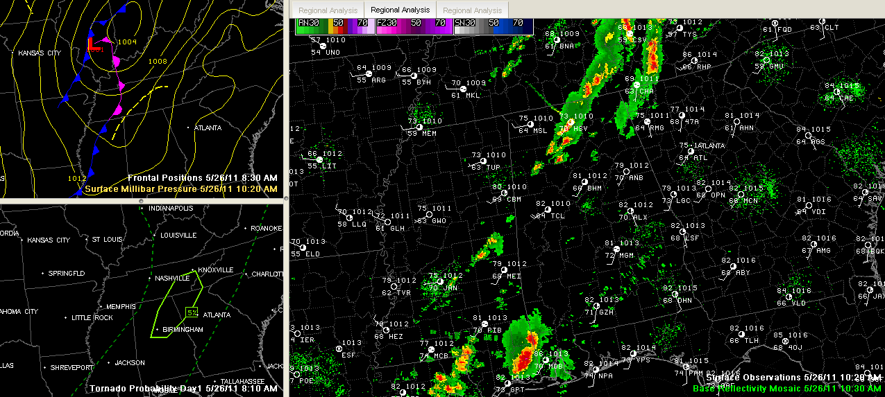
Showers and storms continue ahead of a cold front this morning over Northwest Alabama and eastern Mississippi. New storms are starting to build ahead of this main line of showers and storms.
A severe thunderstorm watch has been issued for much of Central and Northeast Alabama.
Instabilities are moderate and will grow as we go through the day with increasing sunshine. There is also decent speed shear, where the wind increases with height, which gives storms the chance to be organized and last a decent amount of time.
The Significant Tornado Parameter has been fairly high this morning over North Central Alabama, centered around Cullman. But this number is going down will continue to go down as we go through the day. This is because the change in direction of the winds in the lowest levels of the atmosphere was been significant, but that is decreasing.
So we have a situation where the wind shear and instability are not matched up and we like it that way.
Having said all that, there is a small chance of a tornado from about Jefferson County on northeast along I-59 for the next 3-4 hours if storms get going early. The chance is very small, and is nothing like April 27th for sure. The bigger threat will be from hail and damaging winds as the storms get going.
The back edge of the activity is pushing east at 10 mph. I think it will speed up a bit as we go through the day. The RPM model predicts that storms will develop quickly in the next hour or so over Northwest Alabama. They will slowly shift eastward between noon and 6 p.m. It should clear the I-59 corridor by 7 p.m.
The storms should weaken rather quickly thereafter.



